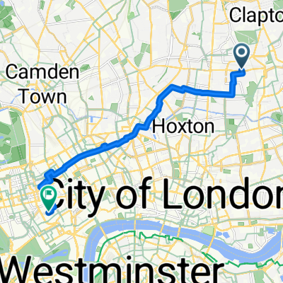
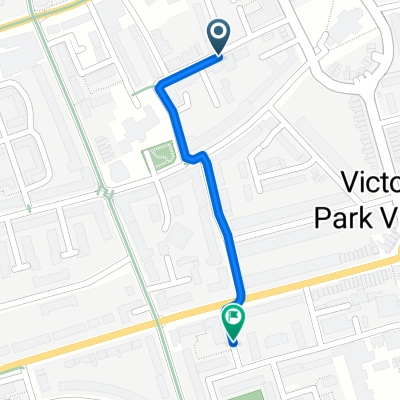
Stokey to Bower High Roads
A cycling route starting in Hackney, England, United Kingdom.
Overview
About this route
Less Main Roads
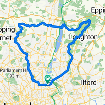
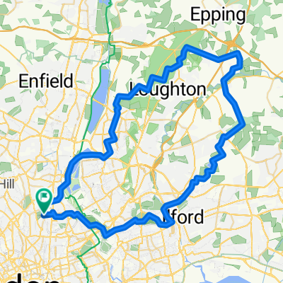
30MPH hill on Romford Road
Takes a solid hour to do.
- -:--
- Duration
- 22 km
- Distance
- 160 m
- Ascent
- 96 m
- Descent
- ---
- Avg. speed
- ---
- Max. altitude
Route quality
Waytypes & surfaces along the route
Waytypes
Quiet road
6.2 km
(28 %)
Road
5.3 km
(24 %)
Surfaces
Paved
12.1 km
(55 %)
Unpaved
0.2 km
(1 %)
Asphalt
11.7 km
(53 %)
Paved (undefined)
0.4 km
(2 %)
Continue with Bikemap
Use, edit, or download this cycling route
You would like to ride Stokey to Bower High Roads or customize it for your own trip? Here is what you can do with this Bikemap route:
Free features
- Save this route as favorite or in collections
- Copy & plan your own version of this route
- Sync your route with Garmin or Wahoo
Premium features
Free trial for 3 days, or one-time payment. More about Bikemap Premium.
- Navigate this route on iOS & Android
- Export a GPX / KML file of this route
- Create your custom printout (try it for free)
- Download this route for offline navigation
Discover more Premium features.
Get Bikemap PremiumFrom our community
Other popular routes starting in Hackney
Stokey to Bower High Roads- Distance
- 22 km
- Ascent
- 160 m
- Descent
- 96 m
- Location
- Hackney, England, United Kingdom
Bike the Bounds of Hackney- Distance
- 28.8 km
- Ascent
- 48 m
- Descent
- 61 m
- Location
- Hackney, England, United Kingdom
Extensive Early Morning Track In London- Distance
- 17.3 km
- Ascent
- 200 m
- Descent
- 201 m
- Location
- Hackney, England, United Kingdom
Dalston to Chigwell- Distance
- 39.6 km
- Ascent
- 168 m
- Descent
- 168 m
- Location
- Hackney, England, United Kingdom
Dunwich Dynamo 2016- Distance
- 179.9 km
- Ascent
- 486 m
- Descent
- 505 m
- Location
- Hackney, England, United Kingdom
Road-Exploring the East- Distance
- 69.9 km
- Ascent
- 267 m
- Descent
- 269 m
- Location
- Hackney, England, United Kingdom
CAMBERSANDS- Distance
- 137 km
- Ascent
- 465 m
- Descent
- 480 m
- Location
- Hackney, England, United Kingdom
Grain - 20.06.20 - 00:01- Distance
- 70.5 km
- Ascent
- 154 m
- Descent
- 150 m
- Location
- Hackney, England, United Kingdom
Open it in the app


