

ASCENSO AL LAGO DE MATTMARK (por Visp)
A cycling route starting in Visp, Valais, Switzerland.
Overview
About this route
El Lago de Mattmark, ubicado en el suroeste de Suiza, es un lugar de extraordinaria belleza natural que también tiene un significado histórico notable. Situado en el cantón del Valais, a una altitud de 2200 metros, este lago artificial se encuentra en el valle de Saas, al sur de la localidad de Saas-Almagell, cerca de la frontera con Italia. Geográficamente, el Lago de Mattmark se localiza en un entorno alpino impresionante, rodeado por majestuosos picos que superan los 4,000 metros, incluyendo el Allalinhorn, Strahlhorn y Monte Rosa. El lago es el resultado de la construcción de una presa de tierra que retiene las aguas del glaciar Allalin y otros glaciares de la región. Este embalse es uno de los más grandes de su tipo en Europa y se encuentra en una zona donde el paisaje está dominado por montañas escarpadas, glaciares y un ambiente alpino austero pero cautivador.
- 3 h 8 min
- Duration
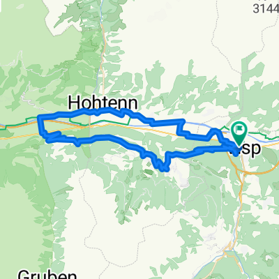
- 34.1 km
- Distance
- 2,075 m
- Ascent
- 507 m
- Descent
- 10.9 km/h
- Avg. speed
- 2,227 m
- Max. altitude

Route photos
\"")
Route quality
Waytypes & surfaces along the route
Waytypes
Busy road
20.7 km
(61 %)
Road
12.7 km
(37 %)
Surfaces
Paved
33.7 km
(99 %)
Unpaved
0 km
(<1 %)
Asphalt
33.4 km
(98 %)
Paved (undefined)
0.3 km
(<1 %)
Continue with Bikemap
Use, edit, or download this cycling route
You would like to ride ASCENSO AL LAGO DE MATTMARK (por Visp) or customize it for your own trip? Here is what you can do with this Bikemap route:
Free features
- Save this route as favorite or in collections
- Copy & plan your own version of this route
- Sync your route with Garmin or Wahoo
Premium features
Free trial for 3 days, or one-time payment. More about Bikemap Premium.
- Navigate this route on iOS & Android
- Export a GPX / KML file of this route
- Create your custom printout (try it for free)
- Download this route for offline navigation
Discover more Premium features.
Get Bikemap PremiumFrom our community
Other popular routes starting in Visp
 Moosalpe via Torbel
- Distance
- 46.4 km
- Ascent
- 1,413 m
- Descent
- 1,413 m
- Location
- Visp, Valais, Switzerland
 2. Andermatt - Trier ( Brig - Villeneuve ) über den Genfer See
- Distance
- 121.6 km
- Ascent
- 35 m
- Descent
- 321 m
- Location
- Visp, Valais, Switzerland
 Visp - Bern
- Distance
- 230.8 km
- Ascent
- 1,508 m
- Descent
- 1,620 m
- Location
- Visp, Valais, Switzerland
 Vispertermine
- Distance
- 19 km
- Ascent
- 989 m
- Descent
- 991 m
- Location
- Visp, Valais, Switzerland
 Visp-Unterbäch-Turtmann-Visp
- Distance
- 42.1 km
- Ascent
- 800 m
- Descent
- 797 m
- Location
- Visp, Valais, Switzerland
 visp montaanta visp
- Distance
- 42.2 km
- Ascent
- 1,061 m
- Descent
- 212 m
- Location
- Visp, Valais, Switzerland
 Transalpine (8) Visp - Medettaz
- Distance
- 89.7 km
- Ascent
- 377 m
- Descent
- 388 m
- Location
- Visp, Valais, Switzerland
 Lalden-Bex-Gstaad-Spiez-Kanderstaeg
- Distance
- 221.8 km
- Ascent
- 2,291 m
- Descent
- 1,762 m
- Location
- Visp, Valais, Switzerland
Open it in the app