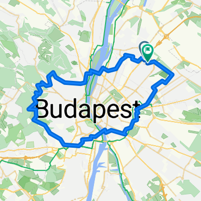
UKSE túra Nagyhideghegyre 2012
A cycling route starting in Budapest XV. kerület, Budapest, Hungary.
Overview
About this route
For those for whom neither the distance nor the mountain poses a problem. Oh, and of course the bumpy gravel road in Börzsöny isn't a problem either...
- -:--
- Duration
- 136.3 km
- Distance
- 902 m
- Ascent
- 905 m
- Descent
- ---
- Avg. speed
- ---
- Max. altitude
Route quality
Waytypes & surfaces along the route
Waytypes
Quiet road
32.7 km
(24 %)
Cycleway
28.6 km
(21 %)
Surfaces
Paved
96.8 km
(71 %)
Unpaved
20.4 km
(15 %)
Asphalt
95.4 km
(70 %)
Gravel
15 km
(11 %)
Route highlights
Points of interest along the route

Photo after 58.9 km
A Börzsöny lábánál, Kóspallagon

Photo after 68.7 km
Itt kezdődik a NHH-re felvivő szerpentin (és a vacak minőségű út)

Photo after 74.2 km
az út minősége: rázós, kavicsos, murvás, vacak, MTB-nak ajánlott

Photo after 77.1 km
A NHH-i turistaház

Point of interest after 77.2 km
Nagyhideghegy (864 m)

Photo after 77.2 km
lenyűgöző panoráma

Photo after 77.2 km
Megint sikerült megtalálni a "jobb útvonalat"...

Photo after 78.6 km
A turistaút, bringásoknak max downhillhez ajánlanám :)
Continue with Bikemap
Use, edit, or download this cycling route
You would like to ride UKSE túra Nagyhideghegyre 2012 or customize it for your own trip? Here is what you can do with this Bikemap route:
Free features
- Save this route as favorite or in collections
- Copy & plan your own version of this route
- Split it into stages to create a multi-day tour
- Sync your route with Garmin or Wahoo
Premium features
Free trial for 3 days, or one-time payment. More about Bikemap Premium.
- Navigate this route on iOS & Android
- Export a GPX / KML file of this route
- Create your custom printout (try it for free)
- Download this route for offline navigation
Discover more Premium features.
Get Bikemap PremiumFrom our community
Other popular routes starting in Budapest XV. kerület
UKSE túra Nagyhideghegyre 2012- Distance
- 136.3 km
- Ascent
- 902 m
- Descent
- 905 m
- Location
- Budapest XV. kerület, Budapest, Hungary
Budapest Magyarország kör- Distance
- 60.5 km
- Ascent
- 700 m
- Descent
- 689 m
- Location
- Budapest XV. kerület, Budapest, Hungary
Otthon - Dunakeszi Csurgó étterem - Otthon- Distance
- 26.5 km
- Ascent
- 42 m
- Descent
- 80 m
- Location
- Budapest XV. kerület, Budapest, Hungary
ride through Budapest XV. kerület- Distance
- 25.7 km
- Ascent
- 36 m
- Descent
- 36 m
- Location
- Budapest XV. kerület, Budapest, Hungary
Börzsönyi barangolás 2012- Distance
- 121.3 km
- Ascent
- 552 m
- Descent
- 554 m
- Location
- Budapest XV. kerület, Budapest, Hungary
Palota-Fót-Őrbottyán-Gödöllő-Fót-Palota- Distance
- 51.5 km
- Ascent
- 304 m
- Descent
- 305 m
- Location
- Budapest XV. kerület, Budapest, Hungary
Mátra 2011.07.31. Kékestető- Distance
- 109.5 km
- Ascent
- 1,205 m
- Descent
- 309 m
- Location
- Budapest XV. kerület, Budapest, Hungary
Solymári edzőkör 2014- Distance
- 52.9 km
- Ascent
- 250 m
- Descent
- 249 m
- Location
- Budapest XV. kerület, Budapest, Hungary
Open it in the app


