

2.7. Golling - Lofer
A cycling route starting in Golling an der Salzach, Salzburg, Austria.
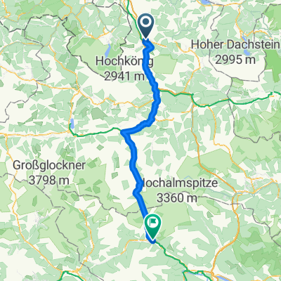
Overview
About this route
Stage 9: We start early and set out on a spectacular and challenging stage. We cross the German border and cycle towards Berchtesgaden where we can see 'Hitler's Eagle's Nest' and pass a salt mine in the area. From there we continue to Hirschbichl and the border to Austria at today's high point of 1200 meters above sea level. Through the Berchtesgaden National Park the road climbs. We pass a picturesque small lake where all cars must park. The road up is a beautiful, quiet climb with some very steep sections (over 20%). The road is closed to motorized traffic; only scheduled buses and cyclists are allowed. The road surface is excellent. The reward when we reach the top is priceless, there is also an inn. We continue steeply down to the 'Tauern radweg' which we follow to Lofer, today's destination. Overnight: Hotel & Restaurant Dankl. Highlights: Berchtesgaden, Hirschbichl
- 5 h 12 min
- Duration
- 78 km
- Distance
- 1,703 m
- Ascent
- 1,549 m
- Descent
- 15 km/h
- Avg. speed
- 711 m
- Max. altitude

Route photos


Route quality
Waytypes & surfaces along the route
Waytypes
Path
19.5 km
(25 %)
Quiet road
14.8 km
(19 %)
Surfaces
Paved
51.5 km
(66 %)
Unpaved
10.1 km
(13 %)
Asphalt
50.7 km
(65 %)
Gravel
8.6 km
(11 %)
Continue with Bikemap
Use, edit, or download this cycling route
You would like to ride 2.7. Golling - Lofer or customize it for your own trip? Here is what you can do with this Bikemap route:
Free features
- Save this route as favorite or in collections
- Copy & plan your own version of this route
- Sync your route with Garmin or Wahoo
Premium features
Free trial for 3 days, or one-time payment. More about Bikemap Premium.
- Navigate this route on iOS & Android
- Export a GPX / KML file of this route
- Create your custom printout (try it for free)
- Download this route for offline navigation
Discover more Premium features.
Get Bikemap PremiumFrom our community
Other popular routes starting in Golling an der Salzach
- 2.7. Golling - Lofer
- Distance
- 78 km
- Ascent
- 1,703 m
- Descent
- 1,549 m
- Location
- Golling an der Salzach, Salzburg, Austria
 1. Salzkammergut Seenrunde
- Distance
- 70.3 km
- Ascent
- 809 m
- Descent
- 625 m
- Location
- Golling an der Salzach, Salzburg, Austria
 2011 Golling-Schladming
- Distance
- 67.1 km
- Ascent
- 648 m
- Descent
- 403 m
- Location
- Golling an der Salzach, Salzburg, Austria
 Golling - Berchtesgadener - Runde
- Distance
- 53.1 km
- Ascent
- 1,584 m
- Descent
- 1,582 m
- Location
- Golling an der Salzach, Salzburg, Austria
 Von Golling an der Salzach bis Salzburg
- Distance
- 33.7 km
- Ascent
- 402 m
- Descent
- 451 m
- Location
- Golling an der Salzach, Salzburg, Austria
 Baldramsdorf - Steindorf am Ossiacher See
- Distance
- 101.9 km
- Ascent
- 1,846 m
- Descent
- 1,637 m
- Location
- Golling an der Salzach, Salzburg, Austria
 Route Bluntautal
- Distance
- 7.9 km
- Ascent
- 183 m
- Descent
- 182 m
- Location
- Golling an der Salzach, Salzburg, Austria
 Mörderische Fahrt in Golling an der Salzach
- Distance
- 43.3 km
- Ascent
- 969 m
- Descent
- 969 m
- Location
- Golling an der Salzach, Salzburg, Austria
Open it in the app