

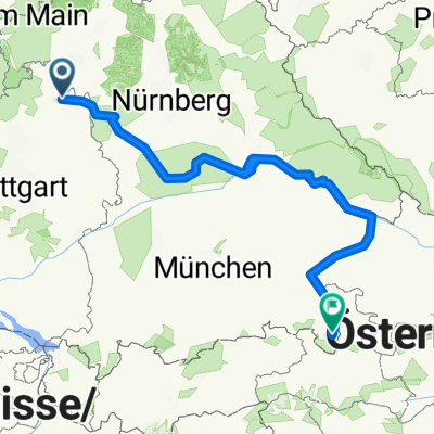
Taubertal - Maintal
A cycling route starting in Bad Mergentheim, Baden-Wurttemberg, Germany.
Overview
About this route
Leicht welliges Gelände und bei Wind besonders fordernd (Gauebene).
- -:--
- Duration
- 84.3 km
- Distance
- 447 m
- Ascent
- 447 m
- Descent
- ---
- Avg. speed
- ---
- Max. altitude
Route quality
Waytypes & surfaces along the route
Waytypes
Busy road
43.6 km
(52 %)
Quiet road
17 km
(20 %)
Surfaces
Paved
58.8 km
(70 %)
Unpaved
0.1 km
(<1 %)
Asphalt
56.4 km
(67 %)
Paved (undefined)
2.3 km
(3 %)
Continue with Bikemap
Use, edit, or download this cycling route
You would like to ride Taubertal - Maintal or customize it for your own trip? Here is what you can do with this Bikemap route:
Free features
- Save this route as favorite or in collections
- Copy & plan your own version of this route
- Split it into stages to create a multi-day tour
- Sync your route with Garmin or Wahoo
Premium features
Free trial for 3 days, or one-time payment. More about Bikemap Premium.
- Navigate this route on iOS & Android
- Export a GPX / KML file of this route
- Create your custom printout (try it for free)
- Download this route for offline navigation
Discover more Premium features.
Get Bikemap PremiumFrom our community
Other popular routes starting in Bad Mergentheim
 HE02-Mergentheim-Colmberg
- Distance
- 67.8 km
- Ascent
- 450 m
- Descent
- 210 m
- Location
- Bad Mergentheim, Baden-Wurttemberg, Germany
 Keltentour
- Distance
- 90.2 km
- Ascent
- 817 m
- Descent
- 815 m
- Location
- Bad Mergentheim, Baden-Wurttemberg, Germany
 Weinbau-Tour
- Distance
- 79.5 km
- Ascent
- 908 m
- Descent
- 905 m
- Location
- Bad Mergentheim, Baden-Wurttemberg, Germany
 Badeseen-Tour
- Distance
- 38.6 km
- Ascent
- 318 m
- Descent
- 318 m
- Location
- Bad Mergentheim, Baden-Wurttemberg, Germany
 Taubertal - Maintal
- Distance
- 84.3 km
- Ascent
- 447 m
- Descent
- 447 m
- Location
- Bad Mergentheim, Baden-Wurttemberg, Germany
 Rothenburg o.T. - Berchtesgaden
- Distance
- 857.9 km
- Ascent
- 738 m
- Descent
- 370 m
- Location
- Bad Mergentheim, Baden-Wurttemberg, Germany
 Taubertal - Vorbachtal - Hohenlohe
- Distance
- 78.1 km
- Ascent
- 513 m
- Descent
- 508 m
- Location
- Bad Mergentheim, Baden-Wurttemberg, Germany
 Streuobstwiesen-Tour
- Distance
- 34 km
- Ascent
- 275 m
- Descent
- 272 m
- Location
- Bad Mergentheim, Baden-Wurttemberg, Germany
Open it in the app