

bike 29.4.2012 - canyon
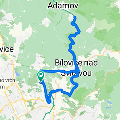
A cycling route starting in Bílovice nad Svitavou, South Moravian, Czechia.
Overview
About this route
Krátký pomotání se v lese za Brnem. Příště si vezmu chrta, nožiska mě bolijou ještě teď.
- -:--
- Duration
- 37.8 km
- Distance
- 722 m
- Ascent
- 722 m
- Descent
- ---
- Avg. speed
- ---
- Max. altitude
Route highlights
Points of interest along the route

Point of interest after 3.1 km
trosky obřanskýho hradu a trosky mýho kola

Point of interest after 5.6 km
občerstvovna u sokolovny

Point of interest after 6.4 km
kříž nad bílovicama

Point of interest after 7.2 km
konečně v lesi

Point of interest after 7.4 km
tam pojedeme, tam to bude hezký

Point of interest after 19.1 km
alexandrova rozhledna

Point of interest after 19.2 km
klučík nahoře na rozhledně

Point of interest after 31 km
vilka s s.k.neumannem v popředí

Point of interest after 32.3 km
ej uchněm... :-/
Continue with Bikemap
Use, edit, or download this cycling route
You would like to ride bike 29.4.2012 - canyon or customize it for your own trip? Here is what you can do with this Bikemap route:
Free features
- Save this route as favorite or in collections
- Copy & plan your own version of this route
- Sync your route with Garmin or Wahoo
Premium features
Free trial for 3 days, or one-time payment. More about Bikemap Premium.
- Navigate this route on iOS & Android
- Export a GPX / KML file of this route
- Create your custom printout (try it for free)
- Download this route for offline navigation
Discover more Premium features.
Get Bikemap PremiumFrom our community
Other popular routes starting in Bílovice nad Svitavou
 Lesná - Černá Hora - Jedovnice - Lesná
- Distance
- 79 km
- Ascent
- 1,053 m
- Descent
- 1,011 m
- Location
- Bílovice nad Svitavou, South Moravian, Czechia
 majdalenky-soběšice-modrá-červená a zpět
- Distance
- 12.5 km
- Ascent
- 250 m
- Descent
- 253 m
- Location
- Bílovice nad Svitavou, South Moravian, Czechia
 DA09: Zadní Hády, Hádecká planina
- Distance
- 25.1 km
- Ascent
- 627 m
- Descent
- 630 m
- Location
- Bílovice nad Svitavou, South Moravian, Czechia
 Lehká projížďka Brno Lesná, Bílovice, Adamov, Bílovice, Obřany, Brno Lesná
- Distance
- 28.9 km
- Ascent
- 270 m
- Descent
- 271 m
- Location
- Bílovice nad Svitavou, South Moravian, Czechia
 Obrany - Slavkov - 50km
- Distance
- 49.2 km
- Ascent
- 624 m
- Descent
- 633 m
- Location
- Bílovice nad Svitavou, South Moravian, Czechia
 Vyhlídka
- Distance
- 27.4 km
- Ascent
- 339 m
- Descent
- 338 m
- Location
- Bílovice nad Svitavou, South Moravian, Czechia
 Bilovice n/S - Kopaniny
- Distance
- 4 km
- Ascent
- 222 m
- Descent
- 39 m
- Location
- Bílovice nad Svitavou, South Moravian, Czechia
 Kondiční vyjížďka
- Distance
- 24.2 km
- Ascent
- 305 m
- Descent
- 305 m
- Location
- Bílovice nad Svitavou, South Moravian, Czechia
Open it in the app