

Le grand prix UCI Pro Tour Bi-hebdomadaire de Leognan
A cycling route starting in Léognan, Nouvelle-Aquitaine, France.
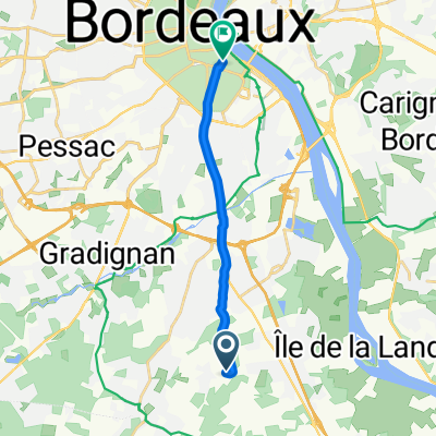
Overview
About this route
The Bordeaux institution from the South...
Every Tuesday AM and every Thursday AM
To ride kilometers without burning up the whole afternoon!
To chat with friends (not always, because sometimes you just have to grit your teeth...)
- -:--
- Duration
- 79.9 km
- Distance
- 247 m
- Ascent
- 228 m
- Descent
- ---
- Avg. speed
- 76 m
- Max. altitude

Route quality
Waytypes & surfaces along the route
Waytypes
Road
42.4 km
(53 %)
Quiet road
12.8 km
(16 %)
Surfaces
Paved
13.6 km
(17 %)
Asphalt
13.6 km
(17 %)
Undefined
66.3 km
(83 %)
Route highlights
Points of interest along the route
Point of interest after 66.5 km
Le "poggio di San Remo"
Continue with Bikemap
Use, edit, or download this cycling route
You would like to ride Le grand prix UCI Pro Tour Bi-hebdomadaire de Leognan or customize it for your own trip? Here is what you can do with this Bikemap route:
Free features
- Save this route as favorite or in collections
- Copy & plan your own version of this route
- Sync your route with Garmin or Wahoo
Premium features
Free trial for 3 days, or one-time payment. More about Bikemap Premium.
- Navigate this route on iOS & Android
- Export a GPX / KML file of this route
- Create your custom printout (try it for free)
- Download this route for offline navigation
Discover more Premium features.
Get Bikemap PremiumFrom our community
Other popular routes starting in Léognan
 De LEOGNAN à CASTELSARASIN
- Distance
- 352.2 km
- Ascent
- 984 m
- Descent
- 832 m
- Location
- Léognan, Nouvelle-Aquitaine, France
 De 7 Allée du Domaine de Glady, Léognan à 7 Allée du Domaine de Glady, Léognan
- Distance
- 21.6 km
- Ascent
- 68 m
- Descent
- 71 m
- Location
- Léognan, Nouvelle-Aquitaine, France
 Home To Work And Back
- Distance
- 9.3 km
- Ascent
- 73 m
- Descent
- 70 m
- Location
- Léognan, Nouvelle-Aquitaine, France
 De Chemin Le Thil, Léognan à 36 Rue du Hamel, Bordeaux
- Distance
- 11.1 km
- Ascent
- 33 m
- Descent
- 50 m
- Location
- Léognan, Nouvelle-Aquitaine, France
 Le grand prix UCI Pro Tour Bi-hebdomadaire de Leognan
- Distance
- 79.9 km
- Ascent
- 247 m
- Descent
- 228 m
- Location
- Léognan, Nouvelle-Aquitaine, France
 Itinéraire sportif en Léognan
- Distance
- 31.9 km
- Ascent
- 192 m
- Descent
- 190 m
- Location
- Léognan, Nouvelle-Aquitaine, France
 De Rue des Menhirs 55, Villenave-d'Ornon à Rue des Menhirs 46, Villenave-d'Ornon
- Distance
- 9.6 km
- Ascent
- 74 m
- Descent
- 78 m
- Location
- Léognan, Nouvelle-Aquitaine, France
 Parcour des Graves - Boucle Bleu
- Distance
- 24.8 km
- Ascent
- 84 m
- Descent
- 86 m
- Location
- Léognan, Nouvelle-Aquitaine, France
Open it in the app