

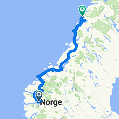
Kaupanger to Solvorn
A cycling route starting in Sogndalsfjøra, Sogn og Fjordane, Norway.
Overview
About this route
- 1 h 52 min
- Duration
- 23.9 km
- Distance
- 425 m
- Ascent
- 538 m
- Descent
- 12.9 km/h
- Avg. speed
- 209 m
- Max. altitude
Route photos


Route quality
Waytypes & surfaces along the route
Waytypes
Cycleway
4.5 km
(19 %)
Quiet road
3.4 km
(14 %)
Surfaces
Paved
21.5 km
(90 %)
Unpaved
0.7 km
(3 %)
Asphalt
21.3 km
(89 %)
Unpaved (undefined)
0.7 km
(3 %)
Continue with Bikemap
Use, edit, or download this cycling route
You would like to ride Kaupanger to Solvorn or customize it for your own trip? Here is what you can do with this Bikemap route:
Free features
- Save this route as favorite or in collections
- Copy & plan your own version of this route
- Sync your route with Garmin or Wahoo
Premium features
Free trial for 3 days, or one-time payment. More about Bikemap Premium.
- Navigate this route on iOS & Android
- Export a GPX / KML file of this route
- Create your custom printout (try it for free)
- Download this route for offline navigation
Discover more Premium features.
Get Bikemap PremiumFrom our community
Other popular routes starting in Sogndalsfjøra
 Kaupanger to Solvorn
- Distance
- 23.9 km
- Ascent
- 425 m
- Descent
- 538 m
- Location
- Sogndalsfjøra, Sogn og Fjordane, Norway
 from the camping to the end of the lake
- Distance
- 23.1 km
- Ascent
- 740 m
- Descent
- 334 m
- Location
- Sogndalsfjøra, Sogn og Fjordane, Norway
 2b_Sogndal-Fortun
- Distance
- 60.3 km
- Ascent
- 624 m
- Descent
- 607 m
- Location
- Sogndalsfjøra, Sogn og Fjordane, Norway
 Sogndal-Flam
- Distance
- 84 km
- Ascent
- 2,548 m
- Descent
- 2,545 m
- Location
- Sogndalsfjøra, Sogn og Fjordane, Norway
 Route im Schneckentempo in Kaupanger
- Distance
- 26.3 km
- Ascent
- 763 m
- Descent
- 584 m
- Location
- Sogndalsfjøra, Sogn og Fjordane, Norway
 5-Sogndal-Flam
- Distance
- 56.2 km
- Ascent
- 365 m
- Descent
- 339 m
- Location
- Sogndalsfjøra, Sogn og Fjordane, Norway
 МЕГАНОРВЕЙ 2
- Distance
- 1,340.4 km
- Ascent
- 4,246 m
- Descent
- 4,238 m
- Location
- Sogndalsfjøra, Sogn og Fjordane, Norway
 Noruega 02 Flam-(Ferry)-Kaupanger-Nerestad
- Distance
- 27 km
- Ascent
- 641 m
- Descent
- 277 m
- Location
- Sogndalsfjøra, Sogn og Fjordane, Norway
Open it in the app