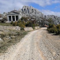
Paklenica-Pag-Paklenica
A cycling route starting in Starigrad, Zadarska Županija, Croatia.
Overview
About this route
28.04.2012
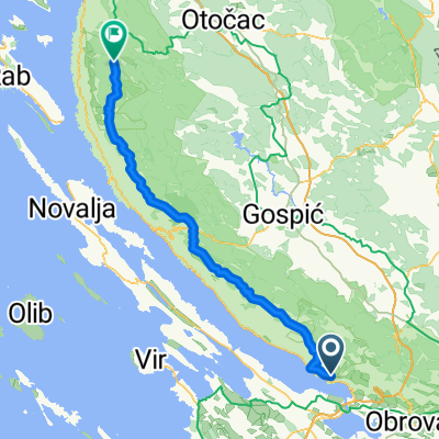
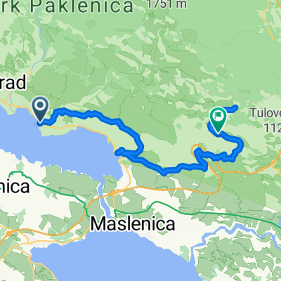
Start malo pred osmo proti Prizni, kamor smo prispeli ob 10.45, in takoj smo zapeljali na trajekt, ki je bil tik pred odhodom. Nato pa ponovno peklenska vročina čez kamniti Pag. Ustavili smo se v lepo opremljenem campu Šimuni, spili radler in odpeljali preko paškega mostu na celino. V Paklenico smo po 165km prispeli ob pol šestih
- -:--
- Duration
- 164.7 km
- Distance
- 993 m
- Ascent
- 996 m
- Descent
- ---
- Avg. speed
- ---
- Avg. speed
Route quality
Waytypes & surfaces along the route
Waytypes
Undefined
164.7 km
(100 %)
Surfaces
Undefined
164.7 km
(100 %)
Continue with Bikemap
Use, edit, or download this cycling route
You would like to ride Paklenica-Pag-Paklenica or customize it for your own trip? Here is what you can do with this Bikemap route:
Free features
- Save this route as favorite or in collections
- Copy & plan your own version of this route
- Sync your route with Garmin or Wahoo
Premium features
Free trial for 3 days, or one-time payment. More about Bikemap Premium.
- Navigate this route on iOS & Android
- Export a GPX / KML file of this route
- Create your custom printout (try it for free)
- Download this route for offline navigation
Discover more Premium features.
Get Bikemap PremiumFrom our community
Other popular routes starting in Starigrad
- Veliko Rujno
- Distance
- 15.4 km
- Ascent
- 1,061 m
- Descent
- 183 m
- Location
- Starigrad, Zadarska Županija, Croatia
- Paklenica
- Distance
- 24.6 km
- Ascent
- 1,024 m
- Descent
- 1,024 m
- Location
- Starigrad, Zadarska Županija, Croatia
- Wanderung in der Schlucht Velika Paklenica
- Distance
- 13 km
- Ascent
- 826 m
- Descent
- 829 m
- Location
- Starigrad, Zadarska Županija, Croatia
- PL. Dom, Paklenica
- Distance
- 23.8 km
- Ascent
- 1,130 m
- Descent
- 1,130 m
- Location
- Starigrad, Zadarska Županija, Croatia
- Paklenica - Mala mocila - Jurline - Paklenica
- Distance
- 13 km
- Ascent
- 1,511 m
- Descent
- 1,487 m
- Location
- Starigrad, Zadarska Županija, Croatia
- Via Dinarica HR-W-09 Nationalpark Paklenica
- Distance
- 16.8 km
- Ascent
- 816 m
- Descent
- 816 m
- Location
- Starigrad, Zadarska Županija, Croatia
- Snail-like route in Starigrad
- Distance
- 13.7 km
- Ascent
- 1,589 m
- Descent
- 1,588 m
- Location
- Starigrad, Zadarska Županija, Croatia
- RADUČ - VELEBIT - RADUČ
- Distance
- 29.3 km
- Ascent
- 715 m
- Descent
- 716 m
- Location
- Starigrad, Zadarska Županija, Croatia