
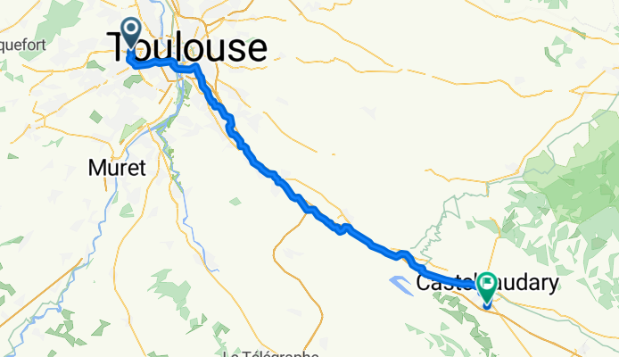
Colomiers to Castelnaudary
A cycling route starting in Colomiers, Occitanie, France.
Overview
About this route
This was our first day of a planned two months on the road. Since this route was virtually all perfectly flat with no traffic along the canal, it was a very nice and gentle start to our self-contained tour.
The portion of the ride along the Canal du Midi in the Haute-Garonne department was probably 90 to 95% paved. There were just a few short sections of dirt or gravel. After we entered the Aude department, the path was mostly unpaved dirt or gravel. It was, though, very rideable..
- 6 h 22 min
- Duration
- 75 km
- Distance
- 181 m
- Ascent
- 168 m
- Descent
- 11.8 km/h
- Avg. speed
- 197 m
- Max. altitude

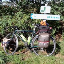
Route photos


Route quality
Waytypes & surfaces along the route
Waytypes
Path
30 km
(40 %)
Cycleway
18 km
(24 %)
Surfaces
Paved
60 km
(80 %)
Unpaved
8.2 km
(11 %)
Asphalt
60 km
(80 %)
Ground
5.2 km
(7 %)
Continue with Bikemap
Use, edit, or download this cycling route
You would like to ride Colomiers to Castelnaudary or customize it for your own trip? Here is what you can do with this Bikemap route:
Free features
- Save this route as favorite or in collections
- Copy & plan your own version of this route
- Sync your route with Garmin or Wahoo
Premium features
Free trial for 3 days, or one-time payment. More about Bikemap Premium.
- Navigate this route on iOS & Android
- Export a GPX / KML file of this route
- Create your custom printout (try it for free)
- Download this route for offline navigation
Discover more Premium features.
Get Bikemap PremiumFrom our community
Other popular routes starting in Colomiers
 Toulouse (Colomiers) to Albi
- Distance
- 101.7 km
- Ascent
- 416 m
- Descent
- 394 m
- Location
- Colomiers, Occitanie, France
 Colomiers to Montauban
- Distance
- 68.2 km
- Ascent
- 197 m
- Descent
- 284 m
- Location
- Colomiers, Occitanie, France
 Tour périphérique VTT
- Distance
- 43.6 km
- Ascent
- 79 m
- Descent
- 79 m
- Location
- Colomiers, Occitanie, France
 Colomiers to Montauban via Le Canal des 2 Mers à Velo
- Distance
- 63.7 km
- Ascent
- 154 m
- Descent
- 181 m
- Location
- Colomiers, Occitanie, France
 Toulouse - Bordeaux
- Distance
- 267.5 km
- Ascent
- 878 m
- Descent
- 1,029 m
- Location
- Colomiers, Occitanie, France
 FR Colom 52km
- Distance
- 51.5 km
- Ascent
- 166 m
- Descent
- 166 m
- Location
- Colomiers, Occitanie, France
 Colomiers to Castelnaudary
- Distance
- 75 km
- Ascent
- 181 m
- Descent
- 168 m
- Location
- Colomiers, Occitanie, France
 Close to home
- Distance
- 7.8 km
- Ascent
- 34 m
- Descent
- 32 m
- Location
- Colomiers, Occitanie, France
Open it in the app