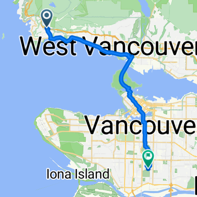
4749 Rutland Rd, West Vancouver to 100 W 49th Ave, Vancouver
- 24.5 km
- 268 m
- 343 m
- West Vancouver, British Columbia, Canada
A cycling route starting in West Vancouver, British Columbia, Canada.
Overview
created this 1 year ago
Route quality
Cycleway
6.4 km
(26 %)
Quiet road
4.9 km
(20 %)
Paved
24 km
(98 %)
Asphalt
18.1 km
(74 %)
Concrete
4.2 km
(17 %)
Continue with Bikemap
You would like to ride 4749 Rutland Rd, West Vancouver to 100 W 49th Ave, Vancouver or customize it for your own trip? Here is what you can do with this Bikemap route:
Free trial for 3 days, or one-time payment. More about Bikemap Premium.
Discover more Premium features.
Get Bikemap PremiumFrom our community
Open it in the app