

8 Caderousse nach Valence
A cycling route starting in Caderousse, Provence-Alpes-Côte d'Azur Region, France.
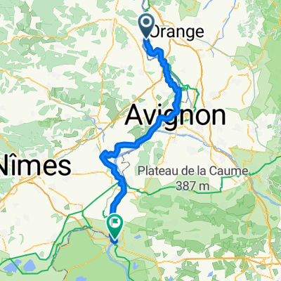
Overview
About this route
- 8 h 14 min
- Duration
- 132.2 km
- Distance
- 533 m
- Ascent
- 431 m
- Descent
- 16.1 km/h
- Avg. speed
- 135 m
- Max. altitude

Route quality
Waytypes & surfaces along the route
Waytypes
Cycleway
56.9 km
(43 %)
Quiet road
46.3 km
(35 %)
Surfaces
Paved
96.5 km
(73 %)
Unpaved
1.3 km
(1 %)
Asphalt
95.2 km
(72 %)
Concrete
1.3 km
(1 %)
Continue with Bikemap
Use, edit, or download this cycling route
You would like to ride 8 Caderousse nach Valence or customize it for your own trip? Here is what you can do with this Bikemap route:
Free features
- Save this route as favorite or in collections
- Copy & plan your own version of this route
- Split it into stages to create a multi-day tour
- Sync your route with Garmin or Wahoo
Premium features
Free trial for 3 days, or one-time payment. More about Bikemap Premium.
- Navigate this route on iOS & Android
- Export a GPX / KML file of this route
- Create your custom printout (try it for free)
- Download this route for offline navigation
Discover more Premium features.
Get Bikemap PremiumFrom our community
Other popular routes starting in Caderousse
 De Chemin de Maucoil, Orange à 80 Boulevard Roger Ricca, Sorgues
- Distance
- 14.8 km
- Ascent
- 126 m
- Descent
- 153 m
- Location
- Caderousse, Provence-Alpes-Côte d'Azur Region, France
 Recording from 30 se Pont Saint Esprit- Rochefort 70km+30
- Distance
- 27.5 km
- Ascent
- 116 m
- Descent
- 124 m
- Location
- Caderousse, Provence-Alpes-Côte d'Azur Region, France
 Roquemaure-Avignon
- Distance
- 25.1 km
- Ascent
- 20 m
- Descent
- 24 m
- Location
- Caderousse, Provence-Alpes-Côte d'Azur Region, France
 Day 5: Caderousse – Avignon – Montfrin – Beaucaire – Arles
- Distance
- 94 km
- Ascent
- 143 m
- Descent
- 164 m
- Location
- Caderousse, Provence-Alpes-Côte d'Azur Region, France
 V. Orange - Arles
- Distance
- 83.4 km
- Ascent
- 400 m
- Descent
- 426 m
- Location
- Caderousse, Provence-Alpes-Côte d'Azur Region, France
 18: ViaRhôna de Caderousse à Avignon
- Distance
- 33 km
- Ascent
- 141 m
- Descent
- 149 m
- Location
- Caderousse, Provence-Alpes-Côte d'Azur Region, France
 pâques en provence ( la trace )
- Distance
- 196.2 km
- Ascent
- 822 m
- Descent
- 822 m
- Location
- Caderousse, Provence-Alpes-Côte d'Azur Region, France
 Via Rhona voorbij Caderousse
- Distance
- 14.1 km
- Ascent
- 40 m
- Descent
- 43 m
- Location
- Caderousse, Provence-Alpes-Côte d'Azur Region, France
Open it in the app