

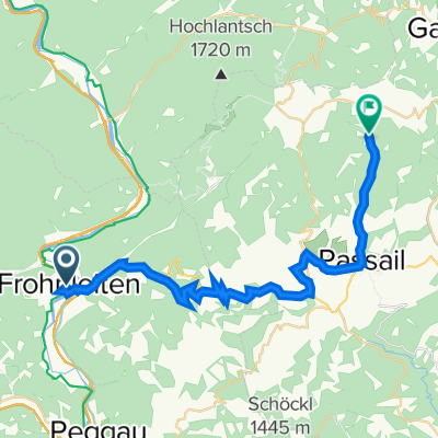
Frohnleiten - Passail
A cycling route starting in Frohnleiten, Styria, Austria.
Overview
About this route
- 4 h 13 min
- Duration
- 55.7 km
- Distance
- 1,623 m
- Ascent
- 1,622 m
- Descent
- 13.2 km/h
- Avg. speed
- 980 m
- Max. altitude

Route quality
Waytypes & surfaces along the route
Waytypes
Quiet road
27.9 km
(50 %)
Road
7.8 km
(14 %)
Surfaces
Paved
36.8 km
(66 %)
Unpaved
0.6 km
(1 %)
Asphalt
35.1 km
(63 %)
Paved (undefined)
1.7 km
(3 %)
Continue with Bikemap
Use, edit, or download this cycling route
You would like to ride Frohnleiten - Passail or customize it for your own trip? Here is what you can do with this Bikemap route:
Free features
- Save this route as favorite or in collections
- Copy & plan your own version of this route
- Sync your route with Garmin or Wahoo
Premium features
Free trial for 3 days, or one-time payment. More about Bikemap Premium.
- Navigate this route on iOS & Android
- Export a GPX / KML file of this route
- Create your custom printout (try it for free)
- Download this route for offline navigation
Discover more Premium features.
Get Bikemap PremiumFrom our community
Other popular routes starting in Frohnleiten
 Frohleiten kratke kolecko
- Distance
- 33.7 km
- Ascent
- 1,006 m
- Descent
- 1,005 m
- Location
- Frohnleiten, Styria, Austria
 Frohnleiten Bruck an der Mur Hochganger Runde
- Distance
- 82.2 km
- Ascent
- 2,351 m
- Descent
- 2,338 m
- Location
- Frohnleiten, Styria, Austria

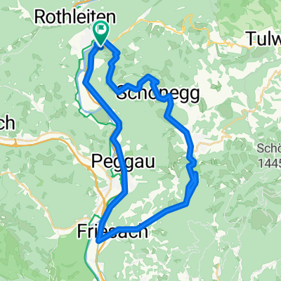
3570®
Frohnleiten-Freisach-Frohnleiten- Distance
- 33.1 km
- Ascent
- 151 m
- Descent
- 154 m
- Location
- Frohnleiten, Styria, Austria
 Frohnleiten nach Graz und retour R2
- Distance
- 67.3 km
- Ascent
- 312 m
- Descent
- 362 m
- Location
- Frohnleiten, Styria, Austria
 frohnleiten-passail-raabqu30km
- Distance
- 29.8 km
- Ascent
- 898 m
- Descent
- 433 m
- Location
- Frohnleiten, Styria, Austria
 Drachentour
- Distance
- 64.4 km
- Ascent
- 2,126 m
- Descent
- 2,113 m
- Location
- Frohnleiten, Styria, Austria
 NKT-Stájer2 túra
- Distance
- 66.1 km
- Ascent
- 1,176 m
- Descent
- 1,178 m
- Location
- Frohnleiten, Styria, Austria
 Frohnleiten-Kesselfall és vissza
- Distance
- 40.9 km
- Ascent
- 1,038 m
- Descent
- 1,039 m
- Location
- Frohnleiten, Styria, Austria
Open it in the app