

ASCENSO A ENGSTLENALP (por Innertkirchen)
A cycling route starting in Meiringen, Canton of Bern, Switzerland.
Overview
About this route
El ascenso a Engstlenalp, en el Oberland bernés de Suiza, es un recorrido menos conocido, pero lleno de encanto alpino, ideal para quienes buscan una experiencia montañosa auténtica y menos transitada. Engstlenalp se encuentra en la región alpina, coronando a una altitud de aproximadamente 1835 metros, y es un punto final de gran belleza natural, rodeado de lagos y montañas, a menudo eclipsado por los ascensos más populares de la zona, como el Sustenpass o el cercano Grimselpass.
- 1 h 35 min
- Duration
- 17.9 km
- Distance
- 1,499 m
- Ascent
- 281 m
- Descent
- 11.3 km/h
- Avg. speed
- 1,849 m
- Max. altitude

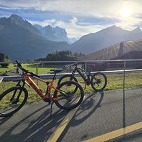
Route photos
\"")
Route quality
Waytypes & surfaces along the route
Waytypes
Quiet road
13.8 km
(77 %)
Access road
0.2 km
(1 %)
Undefined
3.9 km
(22 %)
Surfaces
Paved
8.2 km
(46 %)
Asphalt
8.2 km
(46 %)
Undefined
9.6 km
(54 %)
Continue with Bikemap
Use, edit, or download this cycling route
You would like to ride ASCENSO A ENGSTLENALP (por Innertkirchen) or customize it for your own trip? Here is what you can do with this Bikemap route:
Free features
- Save this route as favorite or in collections
- Copy & plan your own version of this route
- Sync your route with Garmin or Wahoo
Premium features
Free trial for 3 days, or one-time payment. More about Bikemap Premium.
- Navigate this route on iOS & Android
- Export a GPX / KML file of this route
- Create your custom printout (try it for free)
- Download this route for offline navigation
Discover more Premium features.
Get Bikemap PremiumFrom our community
Other popular routes starting in Meiringen
 Lengenacherstrasse nach Lengenacherstrasse
- Distance
- 16.3 km
- Ascent
- 645 m
- Descent
- 721 m
- Location
- Meiringen, Canton of Bern, Switzerland
 Innertkirchen - Aeschi
- Distance
- 86.8 km
- Ascent
- 2,963 m
- Descent
- 2,687 m
- Location
- Meiringen, Canton of Bern, Switzerland
 Grosse Scheidegg rondtour Z-variant
- Distance
- 84 km
- Ascent
- 1,618 m
- Descent
- 2,342 m
- Location
- Meiringen, Canton of Bern, Switzerland
 Allmendstrasse 5, Meiringen nach Allmendstrasse 9, Meiringen
- Distance
- 54.5 km
- Ascent
- 1,490 m
- Descent
- 1,486 m
- Location
- Meiringen, Canton of Bern, Switzerland
 Englerweg 4a nach Lengenacherstrasse
- Distance
- 39.8 km
- Ascent
- 1,191 m
- Descent
- 1,217 m
- Location
- Meiringen, Canton of Bern, Switzerland
 Hauptstrasse, Meiringen nach Jungfraustrasse 14, Thun
- Distance
- 56.3 km
- Ascent
- 792 m
- Descent
- 812 m
- Location
- Meiringen, Canton of Bern, Switzerland
 Alpenbreve Gold
- Distance
- 161.7 km
- Ascent
- 4,980 m
- Descent
- 4,213 m
- Location
- Meiringen, Canton of Bern, Switzerland
 Alpenbrevet Gold
- Distance
- 175.1 km
- Ascent
- 4,954 m
- Descent
- 4,954 m
- Location
- Meiringen, Canton of Bern, Switzerland
Open it in the app