

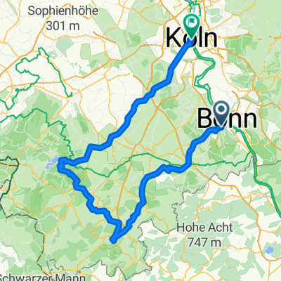
Haager Weg 42, Bonn nach August-Bungert-Allee 11, Leutesdorf
A cycling route starting in Bonn, North Rhine-Westphalia, Germany.
Overview
About this route
- 2 h 46 min
- Duration
- 51.3 km
- Distance
- 247 m
- Ascent
- 359 m
- Descent
- 18.5 km/h
- Avg. speed
- 181 m
- Max. altitude

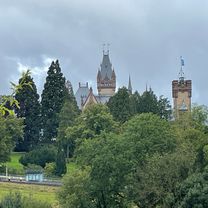
Route photos


Route quality
Waytypes & surfaces along the route
Waytypes
Quiet road
20.5 km
(40 %)
Path
11.8 km
(23 %)
Surfaces
Paved
41.5 km
(81 %)
Unpaved
1 km
(2 %)
Asphalt
39 km
(76 %)
Paved (undefined)
2.6 km
(5 %)
Continue with Bikemap
Use, edit, or download this cycling route
You would like to ride Haager Weg 42, Bonn nach August-Bungert-Allee 11, Leutesdorf or customize it for your own trip? Here is what you can do with this Bikemap route:
Free features
- Save this route as favorite or in collections
- Copy & plan your own version of this route
- Sync your route with Garmin or Wahoo
Premium features
Free trial for 3 days, or one-time payment. More about Bikemap Premium.
- Navigate this route on iOS & Android
- Export a GPX / KML file of this route
- Create your custom printout (try it for free)
- Download this route for offline navigation
Discover more Premium features.
Get Bikemap PremiumFrom our community
Other popular routes starting in Bonn
 Ahrtal-Eifel-Kottenforst
- Distance
- 80.9 km
- Ascent
- 925 m
- Descent
- 910 m
- Location
- Bonn, North Rhine-Westphalia, Germany
 Drachenfels-Milchhäuschen
- Distance
- 38.8 km
- Ascent
- 588 m
- Descent
- 585 m
- Location
- Bonn, North Rhine-Westphalia, Germany
 Auf den Feldern zwischen Köln und Troisdorf
- Distance
- 29.5 km
- Ascent
- 23 m
- Descent
- 24 m
- Location
- Bonn, North Rhine-Westphalia, Germany
 Bonn - Eifel - Westerwald - Bonn
- Distance
- 189.7 km
- Ascent
- 1,343 m
- Descent
- 1,341 m
- Location
- Bonn, North Rhine-Westphalia, Germany
 Flach um Bonn
- Distance
- 56.6 km
- Ascent
- 186 m
- Descent
- 186 m
- Location
- Bonn, North Rhine-Westphalia, Germany
 Bonn - Ahrquelle - Rursee - Köln
- Distance
- 154 km
- Ascent
- 987 m
- Descent
- 1,006 m
- Location
- Bonn, North Rhine-Westphalia, Germany
 Lockere 1Stunde rund und in Beuel
- Distance
- 21.3 km
- Ascent
- 182 m
- Descent
- 168 m
- Location
- Bonn, North Rhine-Westphalia, Germany
 BRT2016-FR: An Rhein und Sieg - PSF des Radsportbezirk Mittelrhein-Süd beim BRT 2016 in Bonn - 76 km Strecke
- Distance
- 74.9 km
- Ascent
- 509 m
- Descent
- 509 m
- Location
- Bonn, North Rhine-Westphalia, Germany
Open it in the app