- 68.8 km
- 135 m
- 143 m
- Weißenfels, Saxony-Anhalt, Germany
Ostroute der Saale-Unstrut -Elster Radacht SUER8
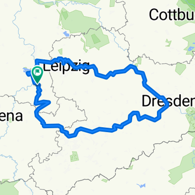
A cycling route starting in Weißenfels, Saxony-Anhalt, Germany.
Overview
About this route
östliche Schleife der Saale-Unstrut-Elster Radacht (SUER8).
- -:--
- Duration
- 109.5 km
- Distance
- 386 m
- Ascent
- 387 m
- Descent
- ---
- Avg. speed
- ---
- Max. altitude
created this 13 years ago
Route quality
Waytypes & surfaces along the route
Waytypes
Track
31.8 km
(29 %)
Quiet road
30.7 km
(28 %)
Surfaces
Paved
84.3 km
(77 %)
Unpaved
15.3 km
(14 %)
Asphalt
80 km
(73 %)
Gravel
12 km
(11 %)
Route highlights
Points of interest along the route
Point of interest after 40.3 km
Alte Bahnlinie Zeitz-Camburg wird zum Bahnradweg ausgebaut. Allerdings wird das wohl noch etwas dauern. Stand der Dinge auf: www.radweg-zeitz-camburg.de
Continue with Bikemap
Use, edit, or download this cycling route
You would like to ride Ostroute der Saale-Unstrut -Elster Radacht SUER8 or customize it for your own trip? Here is what you can do with this Bikemap route:
Free features
- Save this route as favorite or in collections
- Copy & plan your own version of this route
- Split it into stages to create a multi-day tour
- Sync your route with Garmin or Wahoo
Premium features
Free trial for 3 days, or one-time payment. More about Bikemap Premium.
- Navigate this route on iOS & Android
- Export a GPX / KML file of this route
- Create your custom printout (try it for free)
- Download this route for offline navigation
Discover more Premium features.
Get Bikemap PremiumFrom our community
Other popular routes starting in Weißenfels
- SRW_Etappe7
- Schönes Land
- 79.2 km
- 291 m
- 293 m
- Weißenfels, Saxony-Anhalt, Germany
- Zuckerbahn
- 84.3 km
- 368 m
- 375 m
- Weißenfels, Saxony-Anhalt, Germany
- WSF 002: Weißenfelsrunde 2
- 93.3 km
- 347 m
- 347 m
- Weißenfels, Saxony-Anhalt, Germany
- Weißenfels nach Leipzig
- 43.3 km
- 141 m
- 120 m
- Weißenfels, Saxony-Anhalt, Germany
- 12 Apostelbrücke
- 119.4 km
- 360 m
- 360 m
- Weißenfels, Saxony-Anhalt, Germany
- Runde2025
- 487.1 km
- 3,574 m
- 3,573 m
- Weißenfels, Saxony-Anhalt, Germany
- Weißenfels-Bad Kösen-Rehehausen-Apolda
- 60.3 km
- 352 m
- 271 m
- Weißenfels, Saxony-Anhalt, Germany
Open it in the app


