

Doppelberg Hoheried-Freienhausen
A cycling route starting in Baar-Ebenhausen, Bavaria, Germany.
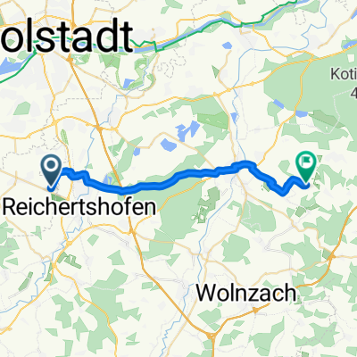
Overview
About this route
two larger mountains
ridden twice
- -:--
- Duration
- 55.3 km
- Distance
- 349 m
- Ascent
- 341 m
- Descent
- ---
- Avg. speed
- 465 m
- Max. altitude
Route quality
Waytypes & surfaces along the route
Waytypes
Quiet road
19.4 km
(35 %)
Road
9.4 km
(17 %)
Surfaces
Paved
15.5 km
(28 %)
Unpaved
0.6 km
(1 %)
Asphalt
15.5 km
(28 %)
Ground
0.6 km
(1 %)
Undefined
39.3 km
(71 %)
Continue with Bikemap
Use, edit, or download this cycling route
You would like to ride Doppelberg Hoheried-Freienhausen or customize it for your own trip? Here is what you can do with this Bikemap route:
Free features
- Save this route as favorite or in collections
- Copy & plan your own version of this route
- Sync your route with Garmin or Wahoo
Premium features
Free trial for 3 days, or one-time payment. More about Bikemap Premium.
- Navigate this route on iOS & Android
- Export a GPX / KML file of this route
- Create your custom printout (try it for free)
- Download this route for offline navigation
Discover more Premium features.
Get Bikemap PremiumFrom our community
Other popular routes starting in Baar-Ebenhausen
 Karlskron - Biergarten Unterpindhart
- Distance
- 22.1 km
- Ascent
- 61 m
- Descent
- 42 m
- Location
- Baar-Ebenhausen, Bavaria, Germany
 Ebenhausen-Schrobenhausen-Pfaffenhofen-Geisenfeld-Ebenhausen
- Distance
- 82.6 km
- Ascent
- 261 m
- Descent
- 258 m
- Location
- Baar-Ebenhausen, Bavaria, Germany
 Doppelberg Hoheried-Freienhausen
- Distance
- 55.3 km
- Ascent
- 349 m
- Descent
- 341 m
- Location
- Baar-Ebenhausen, Bavaria, Germany
 Karlskron-Hohenwart-Mitterscheyern-Tegernbach-Reichertshofen
- Distance
- 56.4 km
- Ascent
- 452 m
- Descent
- 435 m
- Location
- Baar-Ebenhausen, Bavaria, Germany
 Baar-Ebenhausen-Weichering
- Distance
- 62.4 km
- Ascent
- 206 m
- Descent
- 204 m
- Location
- Baar-Ebenhausen, Bavaria, Germany
 Karlskron-Röhrmoos-Schweitenkirchen-Wolnzach-Karlskron
- Distance
- 118.7 km
- Ascent
- 811 m
- Descent
- 788 m
- Location
- Baar-Ebenhausen, Bavaria, Germany
 Rund ums Donaumoos
- Distance
- 34.8 km
- Ascent
- 152 m
- Descent
- 154 m
- Location
- Baar-Ebenhausen, Bavaria, Germany
 Vatertagsrunde
- Distance
- 32.1 km
- Ascent
- 40 m
- Descent
- 39 m
- Location
- Baar-Ebenhausen, Bavaria, Germany
Open it in the app