

Marcel-Breuer-Straße 10, München nach Pfälzer-Wald-Straße 28, München
A cycling route starting in Unterföhring, Bavaria, Germany.
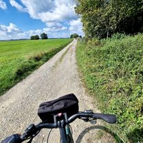
Overview
About this route
- 38 min
- Duration
- 10.8 km
- Distance
- 79 m
- Ascent
- 44 m
- Descent
- 17.1 km/h
- Avg. speed
- 539 m
- Max. altitude
Route quality
Waytypes & surfaces along the route
Waytypes
Path
7.2 km
(67 %)
Quiet road
1.3 km
(12 %)
Surfaces
Paved
5.9 km
(55 %)
Unpaved
4.1 km
(38 %)
Asphalt
5.9 km
(55 %)
Gravel
2.5 km
(23 %)
Continue with Bikemap
Use, edit, or download this cycling route
You would like to ride Marcel-Breuer-Straße 10, München nach Pfälzer-Wald-Straße 28, München or customize it for your own trip? Here is what you can do with this Bikemap route:
Free features
- Save this route as favorite or in collections
- Copy & plan your own version of this route
- Sync your route with Garmin or Wahoo
Premium features
Free trial for 3 days, or one-time payment. More about Bikemap Premium.
- Navigate this route on iOS & Android
- Export a GPX / KML file of this route
- Create your custom printout (try it for free)
- Download this route for offline navigation
Discover more Premium features.
Get Bikemap PremiumFrom our community
Other popular routes starting in Unterföhring
 21.04.
- Distance
- 56.1 km
- Ascent
- 79 m
- Descent
- 82 m
- Location
- Unterföhring, Bavaria, Germany
 Tag 1: Von München nach Schongau
- Distance
- 98.5 km
- Ascent
- 744 m
- Descent
- 599 m
- Location
- Unterföhring, Bavaria, Germany
 Isarradweg
- Distance
- 19.6 km
- Ascent
- 63 m
- Descent
- 113 m
- Location
- Unterföhring, Bavaria, Germany
 München (City-Parktour 3)
- Distance
- 34.9 km
- Ascent
- 54 m
- Descent
- 54 m
- Location
- Unterföhring, Bavaria, Germany
 Pasing Schule
- Distance
- 13.9 km
- Ascent
- 92 m
- Descent
- 63 m
- Location
- Unterföhring, Bavaria, Germany
 kleine runde johnneskirchen
- Distance
- 21.9 km
- Ascent
- 47 m
- Descent
- 49 m
- Location
- Unterföhring, Bavaria, Germany
 Freimann - Grünwald - Freimann
- Distance
- 46.7 km
- Ascent
- 146 m
- Descent
- 145 m
- Location
- Unterföhring, Bavaria, Germany
 Teststrecke nach Starnberg
- Distance
- 33.1 km
- Ascent
- 167 m
- Descent
- 77 m
- Location
- Unterföhring, Bavaria, Germany
Open it in the app