

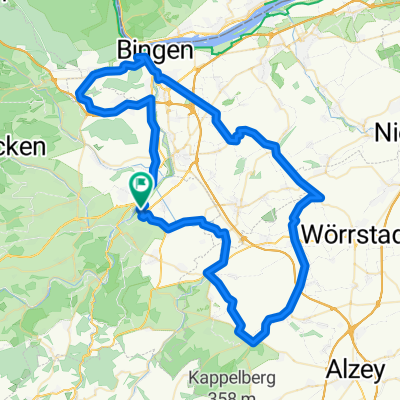
Von der Nahe zum Hunsrück - 75 km Permanente des RC Michelin Bad Kreuznach e.V.
A cycling route starting in Bretzenheim, Rhineland-Palatinate, Germany.
Overview
About this route
Von der Nahe zum Hunsrück - 75 km
Permanente RTF des RC Michelin Bad Kreuznach e.V.
Alle weiteren Hinweise zu dieser Strecke -> hier anklicken
- -:--
- Duration
- 75.1 km
- Distance
- 987 m
- Ascent
- 984 m
- Descent
- ---
- Avg. speed
- 618 m
- Max. altitude

Route quality
Waytypes & surfaces along the route
Waytypes
Busy road
47.9 km
(64 %)
Road
8.1 km
(11 %)
Surfaces
Paved
52.1 km
(69 %)
Asphalt
48.5 km
(65 %)
Paved (undefined)
2.5 km
(3 %)
Route highlights
Points of interest along the route
Point of interest after 46.9 km
Kontrolle Rheinböllen: Hier gilt es, eine Frage im Umfeld des Rathauses zu lösen.
Continue with Bikemap
Use, edit, or download this cycling route
You would like to ride Von der Nahe zum Hunsrück - 75 km Permanente des RC Michelin Bad Kreuznach e.V. or customize it for your own trip? Here is what you can do with this Bikemap route:
Free features
- Save this route as favorite or in collections
- Copy & plan your own version of this route
- Sync your route with Garmin or Wahoo
Premium features
Free trial for 3 days, or one-time payment. More about Bikemap Premium.
- Navigate this route on iOS & Android
- Export a GPX / KML file of this route
- Create your custom printout (try it for free)
- Download this route for offline navigation
Discover more Premium features.
Get Bikemap PremiumFrom our community
Other popular routes starting in Bretzenheim
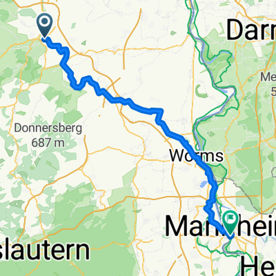
 Von der Nahe zum Rhein - 72 km Permanente des RC Michelin Bad Kreuznach e.V.
- Distance
- 78.5 km
- Ascent
- 724 m
- Descent
- 706 m
- Location
- Bretzenheim, Rhineland-Palatinate, Germany
 Um die Rheinhessische Schweiz - 77 km Permanente des RC Michelin Bad Kreuznach e.V.
- Distance
- 63.9 km
- Ascent
- 470 m
- Descent
- 473 m
- Location
- Bretzenheim, Rhineland-Palatinate, Germany
 Bad Kreuznach - Kirn Papiermühle
- Distance
- 46.4 km
- Ascent
- 260 m
- Descent
- 147 m
- Location
- Bretzenheim, Rhineland-Palatinate, Germany
 An der Kieskaute 19, Bad Kreuznach nach An der Kieskaute 19, Bad Kreuznach
- Distance
- 16.7 km
- Ascent
- 105 m
- Descent
- 107 m
- Location
- Bretzenheim, Rhineland-Palatinate, Germany
 Recovered Route
- Distance
- 42.5 km
- Ascent
- 133 m
- Descent
- 133 m
- Location
- Bretzenheim, Rhineland-Palatinate, Germany
 Am Fuße des Hunsrücks - 74 km Permanente des RC Michelin Bad Kreuznach e.V.
- Distance
- 74.8 km
- Ascent
- 1,172 m
- Descent
- 1,169 m
- Location
- Bretzenheim, Rhineland-Palatinate, Germany
 Naheweinstraße 54B, Bretzenheim nach Naheweinstraße 54B, Bretzenheim
- Distance
- 14.6 km
- Ascent
- 149 m
- Descent
- 150 m
- Location
- Bretzenheim, Rhineland-Palatinate, Germany
 Bourg-en-Bresse Tag 1 KH-Mannh. 83,6 KM
- Distance
- 83.6 km
- Ascent
- 428 m
- Descent
- 427 m
- Location
- Bretzenheim, Rhineland-Palatinate, Germany
Open it in the app