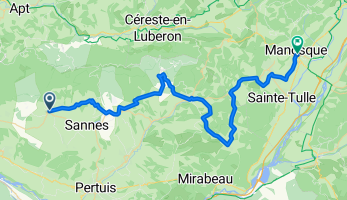


Cucuron-Manosque_Etappe-2 by mnh
- 52.3 km
- 936 m
- 919 m
- Cucuron, Provence-Alpes-Côte d'Azur Region, France
Graveltouren | Provence | France
A cycling route starting in Cucuron, Provence-Alpes-Côte d'Azur Region, France.
Overview
created this 1 year ago
Part of

5 stages

Route quality
Road
40.3 km
(77 %)
Quiet road
4.2 km
(8 %)
Paved
22 km
(42 %)
Asphalt
22 km
(42 %)
Undefined
30.3 km
(58 %)
Continue with Bikemap
You would like to ride Cucuron-Manosque_Etappe-2 by mnh or customize it for your own trip? Here is what you can do with this Bikemap route:
Free trial for 3 days, or one-time payment. More about Bikemap Premium.
Discover more Premium features.
Get Bikemap PremiumFrom our community
Open it in the app