

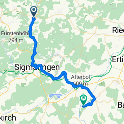
MTB Marathon
A cycling route starting in Veringenstadt, Baden-Wurttemberg, Germany.
Overview
About this route
- -:--
- Duration
- 53.3 km
- Distance
- 989 m
- Ascent
- 959 m
- Descent
- ---
- Avg. speed
- 821 m
- Max. altitude
Route quality
Waytypes & surfaces along the route
Waytypes
Track
47.9 km
(90 %)
Quiet road
3.2 km
(6 %)
Surfaces
Paved
13.3 km
(25 %)
Unpaved
33 km
(62 %)
Gravel
20.8 km
(39 %)
Asphalt
6.9 km
(13 %)
Continue with Bikemap
Use, edit, or download this cycling route
You would like to ride MTB Marathon or customize it for your own trip? Here is what you can do with this Bikemap route:
Free features
- Save this route as favorite or in collections
- Copy & plan your own version of this route
- Sync your route with Garmin or Wahoo
Premium features
Free trial for 3 days, or one-time payment. More about Bikemap Premium.
- Navigate this route on iOS & Android
- Export a GPX / KML file of this route
- Create your custom printout (try it for free)
- Download this route for offline navigation
Discover more Premium features.
Get Bikemap PremiumFrom our community
Other popular routes starting in Veringenstadt
 Ebingen bei den Jungs
- Distance
- 19.3 km
- Ascent
- 281 m
- Descent
- 189 m
- Location
- Veringenstadt, Baden-Wurttemberg, Germany
 Projekt Stetten-Horb am 04.09.2012
- Distance
- 34.6 km
- Ascent
- 191 m
- Descent
- 249 m
- Location
- Veringenstadt, Baden-Wurttemberg, Germany
 Alb Lauchert Tour
- Distance
- 34.5 km
- Ascent
- 308 m
- Descent
- 309 m
- Location
- Veringenstadt, Baden-Wurttemberg, Germany
 Birkenstraße 13, Veringenstadt nach Birkenstraße 11, Veringenstadt
- Distance
- 33 km
- Ascent
- 449 m
- Descent
- 448 m
- Location
- Veringenstadt, Baden-Wurttemberg, Germany
 Samstag 19.09.20
- Distance
- 70.9 km
- Ascent
- 698 m
- Descent
- 697 m
- Location
- Veringenstadt, Baden-Wurttemberg, Germany
 Veringenstadt- Pfullendorf
- Distance
- 34.3 km
- Ascent
- 229 m
- Descent
- 236 m
- Location
- Veringenstadt, Baden-Wurttemberg, Germany
 MTB Marathon
- Distance
- 53.3 km
- Ascent
- 989 m
- Descent
- 959 m
- Location
- Veringenstadt, Baden-Wurttemberg, Germany
 Am Landesbahnhof 4, Sigmaringen nach Am Ring 12, Trochtelfingen
- Distance
- 24.7 km
- Ascent
- 0 m
- Descent
- 0 m
- Location
- Veringenstadt, Baden-Wurttemberg, Germany
Open it in the app