

Lapierre fatranský maratón 2012
A cycling route starting in Rajec, Žilina Region, Slovakia.
Overview
About this route
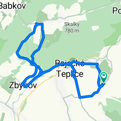
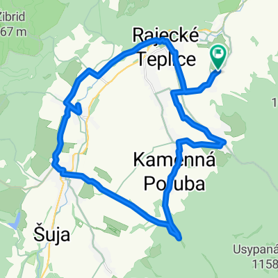
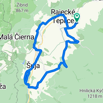
Lapierre (long) The route uses the middle trail that leads through picturesque parts of the Rajec Valley and the Martinský hôľ ridge before swinging over to the enchanting side of the Višňovská Valley. On this route, you'll find long climbs, logging roads, fords, and of course singles. Every rider will definitely find their own favorite part on this trail. The length of 90 km and elevation gain of 2500 m determine for whom the trail is intended.
- -:--
- Duration
- 90 km
- Distance
- 2,084 m
- Ascent
- 2,093 m
- Descent
- ---
- Avg. speed
- ---
- Max. altitude
Continue with Bikemap
Use, edit, or download this cycling route
You would like to ride Lapierre fatranský maratón 2012 or customize it for your own trip? Here is what you can do with this Bikemap route:
Free features
- Save this route as favorite or in collections
- Copy & plan your own version of this route
- Split it into stages to create a multi-day tour
- Sync your route with Garmin or Wahoo
Premium features
Free trial for 3 days, or one-time payment. More about Bikemap Premium.
- Navigate this route on iOS & Android
- Export a GPX / KML file of this route
- Create your custom printout (try it for free)
- Download this route for offline navigation
Discover more Premium features.
Get Bikemap PremiumFrom our community
Other popular routes starting in Rajec
 Stranske - Lietavska Svinna
- Distance
- 20.7 km
- Ascent
- 526 m
- Descent
- 524 m
- Location
- Rajec, Žilina Region, Slovakia
 Stránske do Stránske
- Distance
- 27.8 km
- Ascent
- 375 m
- Descent
- 422 m
- Location
- Rajec, Žilina Region, Slovakia
 Klak Cyklotrasa
- Distance
- 15.6 km
- Ascent
- 688 m
- Descent
- 717 m
- Location
- Rajec, Žilina Region, Slovakia
 Stránske do Stránske
- Distance
- 38.6 km
- Ascent
- 444 m
- Descent
- 481 m
- Location
- Rajec, Žilina Region, Slovakia
 9. Flámm- Okruh Kuneradský zámok- Omegová
- Distance
- 30 km
- Ascent
- 663 m
- Descent
- 660 m
- Location
- Rajec, Žilina Region, Slovakia
 2010-07-14 Lietava
- Distance
- 20.7 km
- Ascent
- 341 m
- Descent
- 336 m
- Location
- Rajec, Žilina Region, Slovakia
 Rajecká dolina Slovensko
- Distance
- 13.7 km
- Ascent
- 205 m
- Descent
- 208 m
- Location
- Rajec, Žilina Region, Slovakia
 Kvakobov trail 4
- Distance
- 27.3 km
- Ascent
- 825 m
- Descent
- 828 m
- Location
- Rajec, Žilina Region, Slovakia
Open it in the app