

Intersport Fatranský maratón 2012
A cycling route starting in Rajec, Žilina Region, Slovakia.
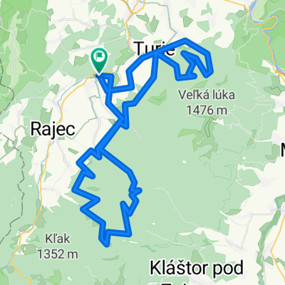
Overview
About this route
<span style="font-size: 11.0pt; line-height: 115%; font-family: "Calibri","sans-serif"; mso-ascii-theme-font: minor-latin; mso-fareast-font-family: Calibri; mso-fareast-theme-font: minor-latin; mso-hansi-theme-font: minor-latin; mso-bidi-font-family: "Times New Roman"; mso-bidi-theme-font: minor-bidi; mso-ansi-language: SK; mso-fareast-language: EN-US; mso-bidi-language: AR-SA;">Intersport (Polmaraton ) Trať je určená pre jazdcov ktorý už čo to odjazdili a chcú si zmerať svoju výkonnosť s tímy najlepšími. Trať ma charakter alpských maratónov .Charakter trate určujú dlhé nikdy nekončiace výšlapy a na druhej strane dlhé zjazdy malebnou krajinou Rajeckej lesnej a hrebeňa Martinský Hôľ .Spomenie ešte obce ktoré budete míňať na svojom bycikli Ako Kunerad ,Kamenná Poroba ,Ďurčiná ,Rajecká Lesná .A samozrejme hostiteľské kúpeľne mestečko Rajecké Teplice . ako aj dĺžka 58km a prevýšenie 1520m veľa predznamenávajú</span>
- -:--
- Duration
- 58.1 km
- Distance
- 1,319 m
- Ascent
- 1,328 m
- Descent
- ---
- Avg. speed
- ---
- Max. altitude
Continue with Bikemap
Use, edit, or download this cycling route
You would like to ride Intersport Fatranský maratón 2012 or customize it for your own trip? Here is what you can do with this Bikemap route:
Free features
- Save this route as favorite or in collections
- Copy & plan your own version of this route
- Sync your route with Garmin or Wahoo
Premium features
Free trial for 3 days, or one-time payment. More about Bikemap Premium.
- Navigate this route on iOS & Android
- Export a GPX / KML file of this route
- Create your custom printout (try it for free)
- Download this route for offline navigation
Discover more Premium features.
Get Bikemap PremiumFrom our community
Other popular routes starting in Rajec
 2. Flámm- Okruh cez Porubsku dolinu
- Distance
- 28.5 km
- Ascent
- 310 m
- Descent
- 309 m
- Location
- Rajec, Žilina Region, Slovakia
 Lapierre fatranský maratón 2012
- Distance
- 90 km
- Ascent
- 2,084 m
- Descent
- 2,093 m
- Location
- Rajec, Žilina Region, Slovakia
 Intersport Fatranský maratón 2012
- Distance
- 58.1 km
- Ascent
- 1,319 m
- Descent
- 1,328 m
- Location
- Rajec, Žilina Region, Slovakia
 Rajec.Teplice- Konská- Rajec- Raj. Lesná (gejzír)
- Distance
- 20 km
- Ascent
- 342 m
- Descent
- 139 m
- Location
- Rajec, Žilina Region, Slovakia
 9. Flámm- Okruh Kuneradský zámok- Omegová
- Distance
- 30 km
- Ascent
- 663 m
- Descent
- 660 m
- Location
- Rajec, Žilina Region, Slovakia
 10. Flámm- Krátky okruh Rajecké Teplice
- Distance
- 7.2 km
- Ascent
- 124 m
- Descent
- 124 m
- Location
- Rajec, Žilina Region, Slovakia
 3. Flámm- Okruh cez Turie
- Distance
- 18.9 km
- Ascent
- 670 m
- Descent
- 675 m
- Location
- Rajec, Žilina Region, Slovakia
 Kvakobov trail 4
- Distance
- 27.3 km
- Ascent
- 825 m
- Descent
- 828 m
- Location
- Rajec, Žilina Region, Slovakia
Open it in the app