

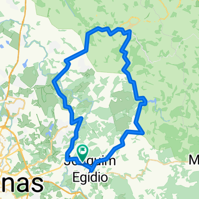
Posto Desativado - Bar do Vicente - Antena da Embratel - Feijão - Posto
A cycling route starting in Valinhos, São Paulo, Brazil.
Overview
About this route
- -:--
- Duration
- 41.1 km
- Distance
- 600 m
- Ascent
- 600 m
- Descent
- ---
- Avg. speed
- ---
- Max. altitude
Route quality
Waytypes & surfaces along the route
Waytypes
Road
27.9 km
(68 %)
Quiet road
1.2 km
(3 %)
Surfaces
Paved
10.3 km
(25 %)
Unpaved
28.7 km
(70 %)
Ground
27.5 km
(67 %)
Asphalt
10.3 km
(25 %)
Route highlights
Points of interest along the route
Point of interest after 10.2 km
Bar do Vicente
Point of interest after 21.1 km
Antenas da Embratel - Morungaba
Continue with Bikemap
Use, edit, or download this cycling route
You would like to ride Posto Desativado - Bar do Vicente - Antena da Embratel - Feijão - Posto or customize it for your own trip? Here is what you can do with this Bikemap route:
Free features
- Save this route as favorite or in collections
- Copy & plan your own version of this route
- Sync your route with Garmin or Wahoo
Premium features
Free trial for 3 days, or one-time payment. More about Bikemap Premium.
- Navigate this route on iOS & Android
- Export a GPX / KML file of this route
- Create your custom printout (try it for free)
- Download this route for offline navigation
Discover more Premium features.
Get Bikemap PremiumFrom our community
Other popular routes starting in Valinhos
 Bocaina
- Distance
- 26 km
- Ascent
- 411 m
- Descent
- 410 m
- Location
- Valinhos, São Paulo, Brazil
 Trilha | JE - Vicentão - Pedreira-Pastinho-C. Médicos-Sousas
- Distance
- 56.9 km
- Ascent
- 651 m
- Descent
- 651 m
- Location
- Valinhos, São Paulo, Brazil
 Contorno Vinhedo-Louveira
- Distance
- 57.7 km
- Ascent
- 495 m
- Descent
- 491 m
- Location
- Valinhos, São Paulo, Brazil
 Volta Valinhos-Itatiba-Vinhedo
- Distance
- 31.4 km
- Ascent
- 565 m
- Descent
- 565 m
- Location
- Valinhos, São Paulo, Brazil
 Rota para Rodovia Jose Bonifacio Coutinho Nogueira, 1716, Campinas
- Distance
- 25.4 km
- Ascent
- 671 m
- Descent
- 686 m
- Location
- Valinhos, São Paulo, Brazil
 Posto Desativado - Bar do Vicente - Antena da Embratel - Feijão - Posto
- Distance
- 41.1 km
- Ascent
- 600 m
- Descent
- 600 m
- Location
- Valinhos, São Paulo, Brazil
 Volta Valinhos-Itatiba-Vinhedo-Valinhos
- Distance
- 53.3 km
- Ascent
- 490 m
- Descent
- 492 m
- Location
- Valinhos, São Paulo, Brazil
 Mazza 11 - quebradeira
- Distance
- 50.9 km
- Ascent
- 1,006 m
- Descent
- 1,006 m
- Location
- Valinhos, São Paulo, Brazil
Open it in the app