

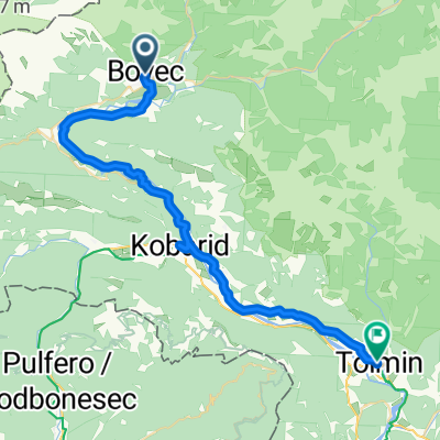
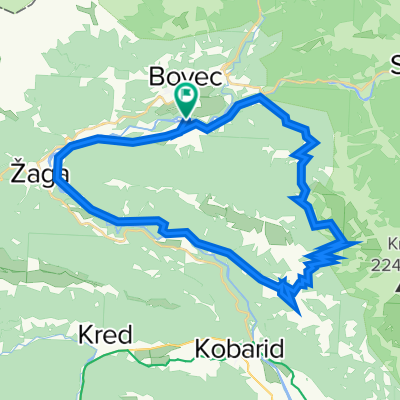
Bovec - sedlo Vršič - Kranjska Gora
A cycling route starting in Bovec, Občina Bovec, Slovenia.
Overview
About this route
Z Bovce přes sedlo Vršič do Kranjske Gory
!!! ten zub v profilu na začátku cesty není, cesta stoupá ze začátku pomalu - správný profil Bovec - Vršič !!!
Cestopis Slovinsko, Chorvatsko 2007
Fotogalerie (část Slovinsko)
- -:--
- Duration
- 42.7 km
- Distance
- 1,648 m
- Ascent
- 1,260 m
- Descent
- ---
- Avg. speed
- 1,626 m
- Max. altitude

Route quality
Waytypes & surfaces along the route
Waytypes
Access road
0.4 km
(1 %)
Undefined
42.3 km
(99 %)
Surfaces
Paved
41 km
(96 %)
Asphalt
41 km
(96 %)
Undefined
1.7 km
(4 %)
Route highlights
Points of interest along the route

Photo after 0.4 km
výjezd z Bovce

Photo after 21.6 km
u tabule 14% stoupání

Point of interest after 24 km
tabule první zatáčky

Photo after 26.3 km
jedna z ostrých zatáček

Photo after 28.9 km
27 zatáčka

Point of interest after 33 km
tabule na vrcholu sedla Vršič 1620 m.n.m.

Photo after 42.7 km
Kranjska Gora
Continue with Bikemap
Use, edit, or download this cycling route
You would like to ride Bovec - sedlo Vršič - Kranjska Gora or customize it for your own trip? Here is what you can do with this Bikemap route:
Free features
- Save this route as favorite or in collections
- Copy & plan your own version of this route
- Sync your route with Garmin or Wahoo
Premium features
Free trial for 3 days, or one-time payment. More about Bikemap Premium.
- Navigate this route on iOS & Android
- Export a GPX / KML file of this route
- Create your custom printout (try it for free)
- Download this route for offline navigation
Discover more Premium features.
Get Bikemap PremiumFrom our community
Other popular routes starting in Bovec
 Pontebba - Bovec
- Distance
- 37.5 km
- Ascent
- 770 m
- Descent
- 1,040 m
- Location
- Bovec, Občina Bovec, Slovenia
 Bovec 24km
- Distance
- 24.6 km
- Ascent
- 527 m
- Descent
- 537 m
- Location
- Bovec, Občina Bovec, Slovenia
 Bovec- Mangarstko sedlo- Bovec
- Distance
- 54.7 km
- Ascent
- 2,209 m
- Descent
- 2,208 m
- Location
- Bovec, Občina Bovec, Slovenia
 2025_09_05_Bovec-Arnoldstein
- Distance
- 64 km
- Ascent
- 2,275 m
- Descent
- 2,171 m
- Location
- Bovec, Občina Bovec, Slovenia
 bovec
bovec- Distance
- 8 km
- Ascent
- 13 m
- Descent
- 172 m
- Location
- Bovec, Občina Bovec, Slovenia
 Zaga into Italy to Sella Nevea, Mangart and Zaga
- Distance
- 97.2 km
- Ascent
- 2,062 m
- Descent
- 2,070 m
- Location
- Bovec, Občina Bovec, Slovenia
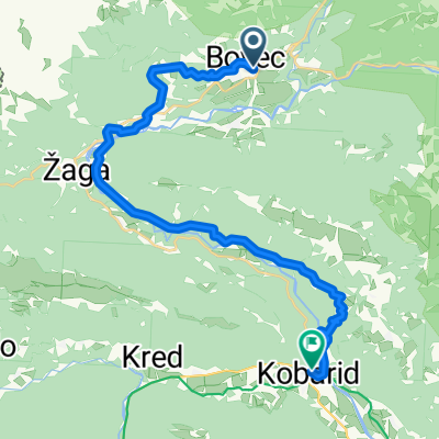 5 Bovec - Drežnica
- Distance
- 24.9 km
- Ascent
- 749 m
- Descent
- 960 m
- Location
- Bovec, Občina Bovec, Slovenia
 Tour 8 Socca Tal
- Distance
- 38.6 km
- Ascent
- 1,194 m
- Descent
- 1,195 m
- Location
- Bovec, Občina Bovec, Slovenia
Open it in the app