
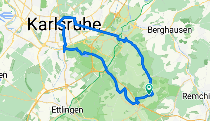
Stupferich - Karlsruhe
A cycling route starting in Ettlingen, Baden-Württemberg, Germany.
Overview
About this route
Der Weg führt zu 95% auf Radwegen durch Karlsruhe. In Durlach sind die Straßen mit einer Ausnahme sehr ruhig mit dem Autoverkehr. Zum Thomashof hoch empfiehlt sich die linke Straßenseite. Erst ab dem Altersheim führt der Radweg rechts der Straße entlang.
- -:--
- Duration
- 28.3 km
- Distance
- 225 m
- Ascent
- 230 m
- Descent
- ---
- Avg. speed
- 274 m
- Max. altitude

Route quality
Waytypes & surfaces along the route
Waytypes
Path
5.2 km
(19 %)
Quiet road
5.1 km
(18 %)
Surfaces
Paved
25.4 km
(90 %)
Unpaved
1.9 km
(7 %)
Asphalt
20.1 km
(71 %)
Paving stones
3.7 km
(13 %)
Continue with Bikemap
Use, edit, or download this cycling route
You would like to ride Stupferich - Karlsruhe or customize it for your own trip? Here is what you can do with this Bikemap route:
Free features
- Save this route as favorite or in collections
- Copy & plan your own version of this route
- Sync your route with Garmin or Wahoo
Premium features
Free trial for 3 days, or one-time payment. More about Bikemap Premium.
- Navigate this route on iOS & Android
- Export a GPX / KML file of this route
- Create your custom printout (try it for free)
- Download this route for offline navigation
Discover more Premium features.
Get Bikemap PremiumFrom our community
Other popular routes starting in Ettlingen
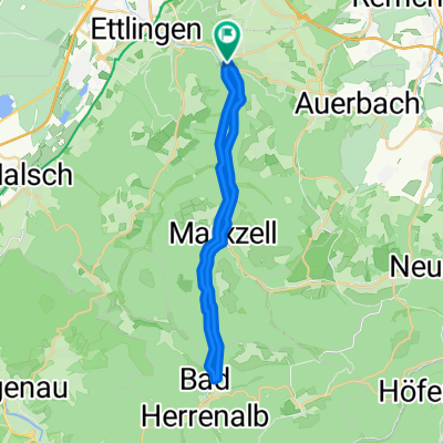 Albtal
- Distance
- 28.8 km
- Ascent
- 552 m
- Descent
- 554 m
- Location
- Ettlingen, Baden-Württemberg, Germany
 Ettlingen -> Hohloh -> Dobel -> Teufelsmühle -> Ettlingen
- Distance
- 129.1 km
- Ascent
- 2,550 m
- Descent
- 2,238 m
- Location
- Ettlingen, Baden-Württemberg, Germany
 Maibike 2012 ProTour
- Distance
- 66.2 km
- Ascent
- 1,011 m
- Descent
- 1,008 m
- Location
- Ettlingen, Baden-Württemberg, Germany
 Feierabendrunde I
- Distance
- 56.7 km
- Ascent
- 903 m
- Descent
- 903 m
- Location
- Ettlingen, Baden-Württemberg, Germany
 Ettlingen - Teufelsmühle - Dobel - Ettlingen
- Distance
- 75.1 km
- Ascent
- 1,074 m
- Descent
- 1,074 m
- Location
- Ettlingen, Baden-Württemberg, Germany
 Testroute flach
- Distance
- 42 km
- Ascent
- 204 m
- Descent
- 207 m
- Location
- Ettlingen, Baden-Württemberg, Germany
 Karlsbad Rundtour
- Distance
- 25.2 km
- Ascent
- 210 m
- Descent
- 283 m
- Location
- Ettlingen, Baden-Württemberg, Germany
 Ettlingen-Teufelsmühle-Ettlingen
- Distance
- 70.6 km
- Ascent
- 973 m
- Descent
- 973 m
- Location
- Ettlingen, Baden-Württemberg, Germany
Open it in the app