

Gärtringen Neuenbürg und zurück
A cycling route starting in Gärtringen, Baden-Wurttemberg, Germany.
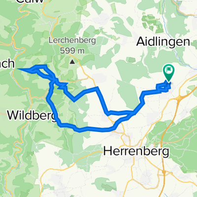
Overview
About this route
Nordschwarzwald road cycling tour on relatively little trafficked roads. Only in the Enz valley on the B 294 between Calmbach and Neuenbürg is there heavy traffic (also on weekends)
- -:--
- Duration
- 110.2 km
- Distance
- 1,811 m
- Ascent
- 1,781 m
- Descent
- ---
- Avg. speed
- 706 m
- Max. altitude
Route quality
Waytypes & surfaces along the route
Waytypes
Road
30.9 km
(28 %)
Track
12.1 km
(11 %)
Surfaces
Paved
90.4 km
(82 %)
Unpaved
5.5 km
(5 %)
Asphalt
88.2 km
(80 %)
Gravel
3.3 km
(3 %)
Continue with Bikemap
Use, edit, or download this cycling route
You would like to ride Gärtringen Neuenbürg und zurück or customize it for your own trip? Here is what you can do with this Bikemap route:
Free features
- Save this route as favorite or in collections
- Copy & plan your own version of this route
- Split it into stages to create a multi-day tour
- Sync your route with Garmin or Wahoo
Premium features
Free trial for 3 days, or one-time payment. More about Bikemap Premium.
- Navigate this route on iOS & Android
- Export a GPX / KML file of this route
- Create your custom printout (try it for free)
- Download this route for offline navigation
Discover more Premium features.
Get Bikemap PremiumFrom our community
Other popular routes starting in Gärtringen
 Classic Training Route
- Distance
- 34.3 km
- Ascent
- 303 m
- Descent
- 305 m
- Location
- Gärtringen, Baden-Wurttemberg, Germany
 zum Einstimmen in die Saison
- Distance
- 39.4 km
- Ascent
- 338 m
- Descent
- 337 m
- Location
- Gärtringen, Baden-Wurttemberg, Germany
 Gärtringen - Oberjesingen - Schönbuch
- Distance
- 26.7 km
- Ascent
- 189 m
- Descent
- 190 m
- Location
- Gärtringen, Baden-Wurttemberg, Germany
 Gärtringen Krabbanescht in Holzbronn
- Distance
- 36.6 km
- Ascent
- 424 m
- Descent
- 422 m
- Location
- Gärtringen, Baden-Wurttemberg, Germany
 Gärtringen, Aidlingen, Dachtel
- Distance
- 16.2 km
- Ascent
- 406 m
- Descent
- 364 m
- Location
- Gärtringen, Baden-Wurttemberg, Germany
 Gärtringen - Deckenpfronn - Rohrau - Aidlingen
- Distance
- 43.2 km
- Ascent
- 349 m
- Descent
- 348 m
- Location
- Gärtringen, Baden-Wurttemberg, Germany
 Gäurandtour
- Distance
- 67.4 km
- Ascent
- 451 m
- Descent
- 451 m
- Location
- Gärtringen, Baden-Wurttemberg, Germany
 Gärtringen - Sulz am Eck - Altdorf
- Distance
- 56.9 km
- Ascent
- 650 m
- Descent
- 668 m
- Location
- Gärtringen, Baden-Wurttemberg, Germany
Open it in the app