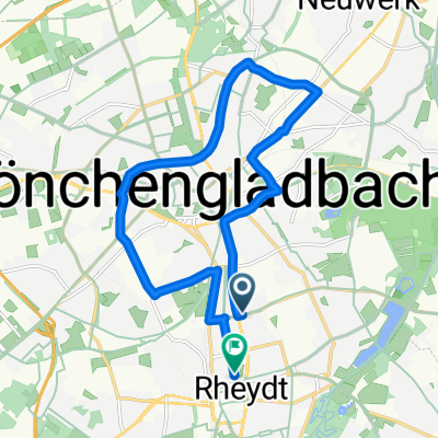
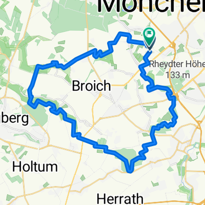
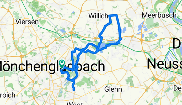
Ruckes40
A cycling route starting in Mönchengladbach, North Rhine-Westphalia, Germany.
Overview
About this route
- -:--
- Duration
- 41.3 km
- Distance
- 37 m
- Ascent
- 43 m
- Descent
- ---
- Avg. speed
- 60 m
- Avg. speed
Route quality
Waytypes & surfaces along the route
Waytypes
Quiet road
15.5 km
(38 %)
Track
13.8 km
(33 %)
Surfaces
Paved
33.8 km
(82 %)
Unpaved
2.9 km
(7 %)
Asphalt
32.8 km
(79 %)
Gravel
2 km
(5 %)
Route highlights
Points of interest along the route
Point of interest after 36.2 km
Ruckes Grill
Continue with Bikemap
Use, edit, or download this cycling route
You would like to ride Ruckes40 or customize it for your own trip? Here is what you can do with this Bikemap route:
Free features
- Save this route as favorite or in collections
- Copy & plan your own version of this route
- Sync your route with Garmin or Wahoo
Premium features
Free trial for 3 days, or one-time payment. More about Bikemap Premium.
- Navigate this route on iOS & Android
- Export a GPX / KML file of this route
- Create your custom printout (try it for free)
- Download this route for offline navigation
Discover more Premium features.
Get Bikemap PremiumFrom our community
Other popular routes starting in Mönchengladbach
- Abendrunde
- Distance
- 30.4 km
- Ascent
- 38 m
- Descent
- 36 m
- Location
- Mönchengladbach, North Rhine-Westphalia, Germany
- Zigarren holen in Holland
- Distance
- 106.1 km
- Ascent
- 204 m
- Descent
- 186 m
- Location
- Mönchengladbach, North Rhine-Westphalia, Germany
- Von Rheydt zum Adolfosee bei Hückelhoven an der Rur
- Distance
- 58.6 km
- Ascent
- 118 m
- Descent
- 118 m
- Location
- Mönchengladbach, North Rhine-Westphalia, Germany
- Ruckes40
- Distance
- 41.3 km
- Ascent
- 37 m
- Descent
- 43 m
- Location
- Mönchengladbach, North Rhine-Westphalia, Germany
- Liedberg, korschenbroich
- Distance
- 22.9 km
- Ascent
- 142 m
- Descent
- 140 m
- Location
- Mönchengladbach, North Rhine-Westphalia, Germany
- Radeln für die Seele. Seen am Niederrhein
- Distance
- 60.7 km
- Ascent
- 179 m
- Descent
- 179 m
- Location
- Mönchengladbach, North Rhine-Westphalia, Germany
- Schöne Rennradstrecke(de Meinweg)
- Distance
- 74.4 km
- Ascent
- 197 m
- Descent
- 177 m
- Location
- Mönchengladbach, North Rhine-Westphalia, Germany
- Venn-Holtmühle-Tüschenbroich-Venn
- Distance
- 41.5 km
- Ascent
- 85 m
- Descent
- 83 m
- Location
- Mönchengladbach, North Rhine-Westphalia, Germany