

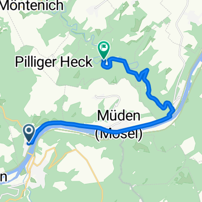
Burg Eltz
A cycling route starting in Treis-Karden, Rhineland-Palatinate, Germany.
Overview
About this route
- -:--
- Duration
- 10.3 km
- Distance
- 220 m
- Ascent
- 187 m
- Descent
- ---
- Avg. speed
- ---
- Max. altitude
Route highlights
Points of interest along the route
Photo after 10.2 km
Continue with Bikemap
Use, edit, or download this cycling route
You would like to ride Burg Eltz or customize it for your own trip? Here is what you can do with this Bikemap route:
Free features
- Save this route as favorite or in collections
- Copy & plan your own version of this route
- Sync your route with Garmin or Wahoo
Premium features
Free trial for 3 days, or one-time payment. More about Bikemap Premium.
- Navigate this route on iOS & Android
- Export a GPX / KML file of this route
- Create your custom printout (try it for free)
- Download this route for offline navigation
Discover more Premium features.
Get Bikemap PremiumFrom our community
Other popular routes starting in Treis-Karden
 Geierlay1
- Distance
- 40.8 km
- Ascent
- 565 m
- Descent
- 564 m
- Location
- Treis-Karden, Rhineland-Palatinate, Germany
 Burg Eltz
- Distance
- 10.3 km
- Ascent
- 220 m
- Descent
- 187 m
- Location
- Treis-Karden, Rhineland-Palatinate, Germany
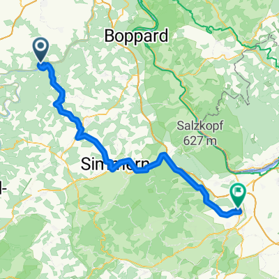
 Da Treis-Karden a Koblenz
- Distance
- 61.3 km
- Ascent
- 380 m
- Descent
- 398 m
- Location
- Treis-Karden, Rhineland-Palatinate, Germany
 Treis-Karden - Lalo
- Distance
- 79.4 km
- Ascent
- 686 m
- Descent
- 657 m
- Location
- Treis-Karden, Rhineland-Palatinate, Germany
 MoselClassic E5 TraisKarden-Koblenz
- Distance
- 41.4 km
- Ascent
- 116 m
- Descent
- 128 m
- Location
- Treis-Karden, Rhineland-Palatinate, Germany
 ET-04 MOSEL-RW KARDEN - MOSELWEIS 39 km - 260 HM.gpx
- Distance
- 38.3 km
- Ascent
- 416 m
- Descent
- 394 m
- Location
- Treis-Karden, Rhineland-Palatinate, Germany
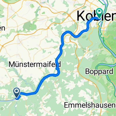
 MoselXL E9 TreisKarden-BurgEltz-Koblenz
- Distance
- 44.2 km
- Ascent
- 143 m
- Descent
- 162 m
- Location
- Treis-Karden, Rhineland-Palatinate, Germany
 Hauptstraße 36, Treis-Karden nach Bahnhofplatz, Koblenz
- Distance
- 40.1 km
- Ascent
- 630 m
- Descent
- 642 m
- Location
- Treis-Karden, Rhineland-Palatinate, Germany
Open it in the app