

Walddrehna Einzelzeitfahren CLONED FROM ROUTE 1563011
A cycling route starting in Sonnewalde, Brandenburg, Germany.
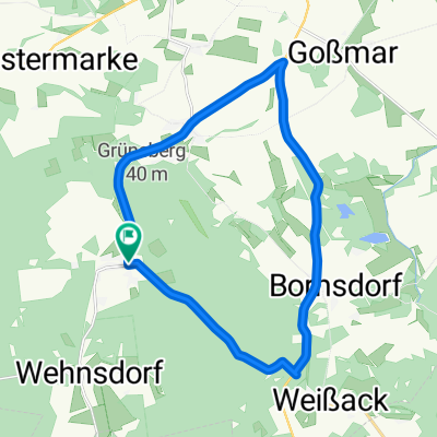
Overview
About this route
The amateur race takes place every year on the Saturday before 'Ascension Day'.
Registration from 1:00 pm, start from 2:30 pm.
Licensed riders will not be classified.
more info:
Jörg Seidel
01713662223
- -:--
- Duration
- 18.6 km
- Distance
- 122 m
- Ascent
- 119 m
- Descent
- ---
- Avg. speed
- ---
- Max. altitude
Route quality
Waytypes & surfaces along the route
Waytypes
Quiet road
1.7 km
(9 %)
Undefined
17 km
(91 %)
Surfaces
Paved
17.3 km
(93 %)
Unpaved
0.2 km
(1 %)
Asphalt
17.3 km
(93 %)
Gravel
0.2 km
(1 %)
Undefined
1.1 km
(6 %)
Continue with Bikemap
Use, edit, or download this cycling route
You would like to ride Walddrehna Einzelzeitfahren CLONED FROM ROUTE 1563011 or customize it for your own trip? Here is what you can do with this Bikemap route:
Free features
- Save this route as favorite or in collections
- Copy & plan your own version of this route
- Sync your route with Garmin or Wahoo
Premium features
Free trial for 3 days, or one-time payment. More about Bikemap Premium.
- Navigate this route on iOS & Android
- Export a GPX / KML file of this route
- Create your custom printout (try it for free)
- Download this route for offline navigation
Discover more Premium features.
Get Bikemap PremiumFrom our community
Other popular routes starting in Sonnewalde
 Baggerseen RR Tour mit Firlie
- Distance
- 90.9 km
- Ascent
- 242 m
- Descent
- 246 m
- Location
- Sonnewalde, Brandenburg, Germany
 Lausitzcup 1
- Distance
- 18.6 km
- Ascent
- 128 m
- Descent
- 128 m
- Location
- Sonnewalde, Brandenburg, Germany
 Zeckerin - Lübben über Burg
- Distance
- 70.1 km
- Ascent
- 103 m
- Descent
- 158 m
- Location
- Sonnewalde, Brandenburg, Germany
 Zur Dahmequelle
- Distance
- 55.4 km
- Ascent
- 161 m
- Descent
- 216 m
- Location
- Sonnewalde, Brandenburg, Germany
 Walddrehna Einzelzeitfahren CLONED FROM ROUTE 1563011
- Distance
- 18.6 km
- Ascent
- 122 m
- Descent
- 119 m
- Location
- Sonnewalde, Brandenburg, Germany
 Route zum Schlabendorfer See
- Distance
- 48.8 km
- Ascent
- 28 m
- Descent
- 141 m
- Location
- Sonnewalde, Brandenburg, Germany
 Durch die Niederlausitzer Heide 3
- Distance
- 37.7 km
- Ascent
- 62 m
- Descent
- 83 m
- Location
- Sonnewalde, Brandenburg, Germany
 28er MTB WDR-Runde
- Distance
- 27.7 km
- Ascent
- 319 m
- Descent
- 319 m
- Location
- Sonnewalde, Brandenburg, Germany
Open it in the app