
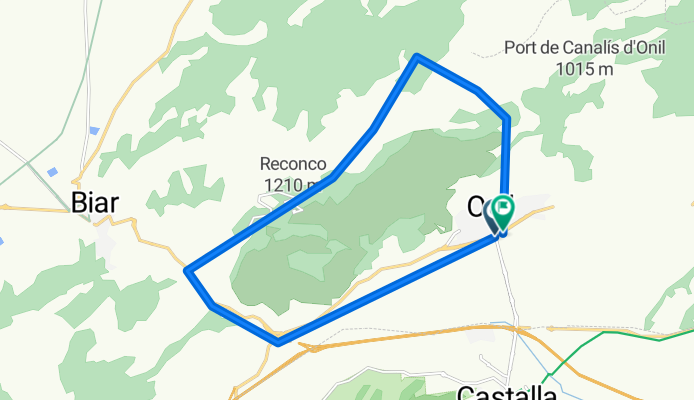
Onil-Biar
A cycling route starting in Onil, Valencia, Spain.
Overview
About this route
Ruta dificultad media con tramos largos de ascenso.
Algunos tramos de asfalto y otros e tierra, con tramos un poco técnicos.
- -:--
- Duration
- 18 km
- Distance
- 773 m
- Ascent
- 763 m
- Descent
- ---
- Avg. speed
- ---
- Max. altitude
Route highlights
Points of interest along the route
Point of interest after 6.1 km
Fuente
Continue with Bikemap
Use, edit, or download this cycling route
You would like to ride Onil-Biar or customize it for your own trip? Here is what you can do with this Bikemap route:
Free features
- Save this route as favorite or in collections
- Copy & plan your own version of this route
- Sync your route with Garmin or Wahoo
Premium features
Free trial for 3 days, or one-time payment. More about Bikemap Premium.
- Navigate this route on iOS & Android
- Export a GPX / KML file of this route
- Create your custom printout (try it for free)
- Download this route for offline navigation
Discover more Premium features.
Get Bikemap PremiumFrom our community
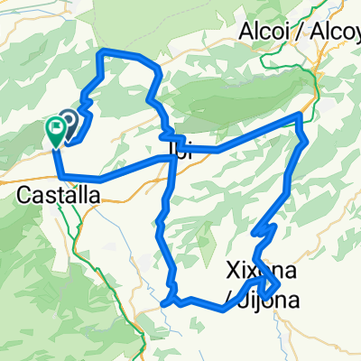
Other popular routes starting in Onil
 Balcó d'Alacant
- Distance
- 20.1 km
- Ascent
- 515 m
- Descent
- 250 m
- Location
- Onil, Valencia, Spain
 Ruta Carretera 23
- Distance
- 84.8 km
- Ascent
- 1,264 m
- Descent
- 1,296 m
- Location
- Onil, Valencia, Spain
 Onil-L'Orxa-Villalonga i tornada pel camping
- Distance
- 170.1 km
- Ascent
- 2,144 m
- Descent
- 2,145 m
- Location
- Onil, Valencia, Spain
 onil-bañeres tcaf a
- Distance
- 39.4 km
- Ascent
- 611 m
- Descent
- 611 m
- Location
- Onil, Valencia, Spain
 Onil-Confrides.Coll de Rates- Castell de castells-Benilloba-Alcoi-Biscoi-Onil
- Distance
- 157.6 km
- Ascent
- 2,139 m
- Descent
- 2,136 m
- Location
- Onil, Valencia, Spain
 Onil-Gorga-Planes-Salem i tornada per Muro i Camping
- Distance
- 151 km
- Ascent
- 1,667 m
- Descent
- 1,667 m
- Location
- Onil, Valencia, Spain
 Onil Tudons benifallim
- Distance
- 133 km
- Ascent
- 2,033 m
- Descent
- 2,033 m
- Location
- Onil, Valencia, Spain
 Onil-Tàrbena-Xaló-Bèrnia-xaló-Tàrbena-Onil
- Distance
- 219.5 km
- Ascent
- 2,399 m
- Descent
- 2,399 m
- Location
- Onil, Valencia, Spain
Open it in the app