

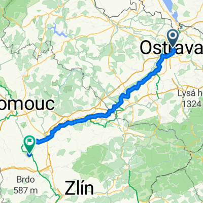
Hermanicke rybniky
A cycling route starting in Ostrava, Moravskoslezský kraj, Czechia.
Overview
About this route
- -:--
- Duration
- 17.7 km
- Distance
- 98 m
- Ascent
- 98 m
- Descent
- ---
- Avg. speed
- ---
- Max. altitude

Route highlights
Points of interest along the route

Point of interest after 9.6 km

Point of interest after 10.5 km

Point of interest after 10.5 km

Point of interest after 10.7 km

Point of interest after 10.9 km

Point of interest after 15.7 km
Continue with Bikemap
Use, edit, or download this cycling route
You would like to ride Hermanicke rybniky or customize it for your own trip? Here is what you can do with this Bikemap route:
Free features
- Save this route as favorite or in collections
- Copy & plan your own version of this route
- Sync your route with Garmin or Wahoo
Premium features
Free trial for 3 days, or one-time payment. More about Bikemap Premium.
- Navigate this route on iOS & Android
- Export a GPX / KML file of this route
- Create your custom printout (try it for free)
- Download this route for offline navigation
Discover more Premium features.
Get Bikemap PremiumFrom our community
Other popular routes starting in Ostrava
 Bělský les - JIstebník - Proskovice a zpět
- Distance
- 23.9 km
- Ascent
- 67 m
- Descent
- 82 m
- Location
- Ostrava, Moravskoslezský kraj, Czechia
 Ostrava - Podturen
- Distance
- 210.5 km
- Ascent
- 4,005 m
- Descent
- 3,600 m
- Location
- Ostrava, Moravskoslezský kraj, Czechia
 20140823 - Trénink Ostrava - Janovice - Ostrava
- Distance
- 69.7 km
- Ascent
- 325 m
- Descent
- 328 m
- Location
- Ostrava, Moravskoslezský kraj, Czechia
 Hermanicke rybniky
- Distance
- 17.7 km
- Ascent
- 98 m
- Descent
- 98 m
- Location
- Ostrava, Moravskoslezský kraj, Czechia
 Ostrava - Olešná - FM - Vratimov - a zpět
- Distance
- 39.8 km
- Ascent
- 123 m
- Descent
- 123 m
- Location
- Ostrava, Moravskoslezský kraj, Czechia
 Ostravské Cyklobuznění 2015
- Distance
- 79.9 km
- Ascent
- 822 m
- Descent
- 775 m
- Location
- Ostrava, Moravskoslezský kraj, Czechia
 Ostrava - Chropyně
- Distance
- 113.3 km
- Ascent
- 712 m
- Descent
- 727 m
- Location
- Ostrava, Moravskoslezský kraj, Czechia
 Zábřeh_Paskov_Krmelín a zpět
- Distance
- 29.8 km
- Ascent
- 109 m
- Descent
- 106 m
- Location
- Ostrava, Moravskoslezský kraj, Czechia
Open it in the app