

Zwönitz
A cycling route starting in Neukirchen, Saxony, Germany.
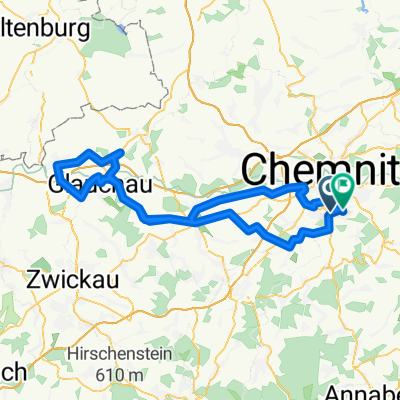
Overview
About this route
Meinsdorf
Hormersdorf
Geyrischer Teich
DJH Hormersdorf (Gifthütte)
Gifthüttenweg nach
Zwönitz
Dorfchemnitz (Knochenmühle)
Alte Dorfchemnitzer Straße (beschwerlich)
Brünlos
Stollberg (ev Straßenbahn nach Chemnitz)
Pfaffenhain
Neukirchen
Chemnitz
- -:--
- Duration
- 52.3 km
- Distance
- 727 m
- Ascent
- 723 m
- Descent
- ---
- Avg. speed
- ---
- Max. altitude

Route quality
Waytypes & surfaces along the route
Waytypes
Busy road
19.3 km
(37 %)
Track
11.3 km
(22 %)
Surfaces
Paved
39 km
(74 %)
Unpaved
9.8 km
(19 %)
Asphalt
36.8 km
(70 %)
Gravel
4.8 km
(9 %)
Route highlights
Points of interest along the route
Point of interest after 13.7 km
Ruine einer Brücke
Point of interest after 13.8 km
ehemaliger Kulturpalast
Point of interest after 17.4 km
Point of interest after 18 km
am Parkplatz durch den Wald zur Jugendherberge
Point of interest after 21.4 km
Stausee Geyer
Point of interest after 23 km
Point of interest after 31.6 km
Knochenstampfe
Point of interest after 38.1 km
Schoss Hoheneck
Continue with Bikemap
Use, edit, or download this cycling route
You would like to ride Zwönitz or customize it for your own trip? Here is what you can do with this Bikemap route:
Free features
- Save this route as favorite or in collections
- Copy & plan your own version of this route
- Sync your route with Garmin or Wahoo
Premium features
Free trial for 3 days, or one-time payment. More about Bikemap Premium.
- Navigate this route on iOS & Android
- Export a GPX / KML file of this route
- Create your custom printout (try it for free)
- Download this route for offline navigation
Discover more Premium features.
Get Bikemap PremiumFrom our community
Other popular routes starting in Neukirchen
 500 Hm Trainingsrunde
- Distance
- 36.6 km
- Ascent
- 595 m
- Descent
- 595 m
- Location
- Neukirchen, Saxony, Germany
 ADFC Feierabend
- Distance
- 27.5 km
- Ascent
- 286 m
- Descent
- 270 m
- Location
- Neukirchen, Saxony, Germany
 Chemnitz - Südböhmen - Südmähren
- Distance
- 844.3 km
- Ascent
- 2,001 m
- Descent
- 2,130 m
- Location
- Neukirchen, Saxony, Germany
 RR Tour Meerane
- Distance
- 99.6 km
- Ascent
- 423 m
- Descent
- 388 m
- Location
- Neukirchen, Saxony, Germany
 Zwönitz
- Distance
- 52.3 km
- Ascent
- 727 m
- Descent
- 723 m
- Location
- Neukirchen, Saxony, Germany
 Oberwald Hohenstein querdurch
- Distance
- 42.8 km
- Ascent
- 430 m
- Descent
- 433 m
- Location
- Neukirchen, Saxony, Germany
 Lichtenstein über Ursprung
- Distance
- 43 km
- Ascent
- 331 m
- Descent
- 329 m
- Location
- Neukirchen, Saxony, Germany
 Erzgebirgstour
- Distance
- 96.5 km
- Ascent
- 1,517 m
- Descent
- 1,494 m
- Location
- Neukirchen, Saxony, Germany
Open it in the app