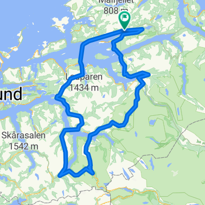
Rundt Langfjorden
A cycling route starting in Hjelset, Møre og Romsdal fylke, Norway.
Overview
About this route
fin rute
- -:--
- Duration
- 96 km
- Distance
- 888 m
- Ascent
- 881 m
- Descent
- ---
- Avg. speed
- ---
- Avg. speed
Route quality
Waytypes & surfaces along the route
Waytypes
Busy road
83.6 km
(87 %)
Quiet road
5.8 km
(6 %)
Surfaces
Paved
84.8 km
(88 %)
Unpaved
0.1 km
(<1 %)
Asphalt
84.8 km
(88 %)
Unpaved (undefined)
0.1 km
(<1 %)
Undefined
11.1 km
(12 %)
Continue with Bikemap
Use, edit, or download this cycling route
You would like to ride Rundt Langfjorden or customize it for your own trip? Here is what you can do with this Bikemap route:
Free features
- Save this route as favorite or in collections
- Copy & plan your own version of this route
- Sync your route with Garmin or Wahoo
Premium features
Free trial for 3 days, or one-time payment. More about Bikemap Premium.
- Navigate this route on iOS & Android
- Export a GPX / KML file of this route
- Create your custom printout (try it for free)
- Download this route for offline navigation
Discover more Premium features.
Get Bikemap PremiumFrom our community
Other popular routes starting in Hjelset
- Sekundær Fylkesvei 195 781 to Sekundær Fylkesvei 195 30
- Distance
- 0.4 km
- Ascent
- 0 m
- Descent
- 56 m
- Location
- Hjelset, Møre og Romsdal fylke, Norway
- De Batnfjordsvegen 1006 à Bergsøysundbrua
- Distance
- 29.2 km
- Ascent
- 192 m
- Descent
- 373 m
- Location
- Hjelset, Møre og Romsdal fylke, Norway
- Rørvik (Molde) - Kvalvåg (Torvikbukt)
- Distance
- 63.8 km
- Ascent
- 759 m
- Descent
- 742 m
- Location
- Hjelset, Møre og Romsdal fylke, Norway
- Sekundær Fylkesvei 195 781 to Sekundær Fylkesvei 195 30
- Distance
- 1 km
- Ascent
- 0 m
- Descent
- 56 m
- Location
- Hjelset, Møre og Romsdal fylke, Norway
- Rundt Langfjorden
- Distance
- 96 km
- Ascent
- 888 m
- Descent
- 881 m
- Location
- Hjelset, Møre og Romsdal fylke, Norway
- Easy MTB trail on gravel
- Distance
- 7.2 km
- Ascent
- 198 m
- Descent
- 155 m
- Location
- Hjelset, Møre og Romsdal fylke, Norway
- Tour de Møre 2012 etappe 2b
- Distance
- 37.3 km
- Ascent
- 405 m
- Descent
- 402 m
- Location
- Hjelset, Møre og Romsdal fylke, Norway
- Solsnes Sunndalsora
- Distance
- 161.1 km
- Ascent
- 1,790 m
- Descent
- 1,754 m
- Location
- Hjelset, Møre og Romsdal fylke, Norway
Open it in the app