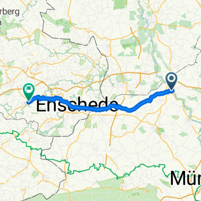
Elte-Emsdetten-Neuenkirchen-Tour
A cycling route starting in Rheine, North Rhine-Westphalia, Germany.
Overview
About this route
-Sehr ruhig zu fahren
- -:--
- Duration
- 44.7 km
- Distance
- 84 m
- Ascent
- 83 m
- Descent
- ---
- Avg. speed
- ---
- Avg. speed
Route quality
Waytypes & surfaces along the route
Waytypes
Quiet road
21.8 km
(49 %)
Road
7.3 km
(16 %)
Surfaces
Paved
31.2 km
(70 %)
Unpaved
1.7 km
(4 %)
Asphalt
25.7 km
(57 %)
Paved (undefined)
3.8 km
(9 %)
Route highlights
Points of interest along the route
Point of interest after 9.3 km
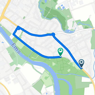
Der Splenterkotten, ein absolutes Muss für alle, die ehm, sagen wir mal essen wollen ;)
Point of interest after 11.7 km
Möglichkeit, zum Übersetzen der EMS
Point of interest after 24.5 km
Emsdettener venn: Hochmoor Gebiet Mit Moorlehpfad
Point of interest after 28 km
Tierheim Rote Erde
Continue with Bikemap
Use, edit, or download this cycling route
You would like to ride Elte-Emsdetten-Neuenkirchen-Tour or customize it for your own trip? Here is what you can do with this Bikemap route:
Free features
- Save this route as favorite or in collections
- Copy & plan your own version of this route
- Sync your route with Garmin or Wahoo
Premium features
Free trial for 3 days, or one-time payment. More about Bikemap Premium.
- Navigate this route on iOS & Android
- Export a GPX / KML file of this route
- Create your custom printout (try it for free)
- Download this route for offline navigation
Discover more Premium features.
Get Bikemap PremiumFrom our community
Other popular routes starting in Rheine
- Radbahn Münsterland
- Distance
- 36.4 km
- Ascent
- 101 m
- Descent
- 53 m
- Location
- Rheine, North Rhine-Westphalia, Germany
- Nasses Eck - Elte
- Distance
- 30 km
- Ascent
- 58 m
- Descent
- 56 m
- Location
- Rheine, North Rhine-Westphalia, Germany
- Rheine Spelle Moorcafe
- Distance
- 40.3 km
- Ascent
- 65 m
- Descent
- 65 m
- Location
- Rheine, North Rhine-Westphalia, Germany
- Rheine-Tecklenburg
- Distance
- 73.5 km
- Ascent
- 285 m
- Descent
- 283 m
- Location
- Rheine, North Rhine-Westphalia, Germany
- Rundstrecke Rheine Mesum Elte
- Distance
- 32.5 km
- Ascent
- 81 m
- Descent
- 81 m
- Location
- Rheine, North Rhine-Westphalia, Germany
- Hase-Ems-Weg - 1 Tag
- Distance
- 41.7 km
- Ascent
- 63 m
- Descent
- 75 m
- Location
- Rheine, North Rhine-Westphalia, Germany
- Elte-Emsdetten-Neuenkirchen-Tour
- Distance
- 44.7 km
- Ascent
- 84 m
- Descent
- 83 m
- Location
- Rheine, North Rhine-Westphalia, Germany
- Rheine-Ewige Liebe
- Distance
- 30.1 km
- Ascent
- 94 m
- Descent
- 93 m
- Location
- Rheine, North Rhine-Westphalia, Germany
Open it in the app