

The Ras 2012 - Stage 1
A cycling route starting in Dunboyne, Leinster, Ireland.
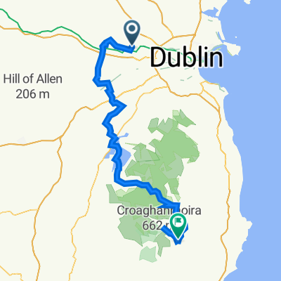
Overview
About this route
Routing by teamskyfans.comif using our routes please credit us
- -:--
- Duration
- 144.6 km
- Distance
- 489 m
- Ascent
- 503 m
- Descent
- ---
- Avg. speed
- ---
- Max. altitude

Route quality
Waytypes & surfaces along the route
Waytypes
Quiet road
24.6 km
(17 %)
Road
11.6 km
(8 %)
Surfaces
Paved
96.9 km
(67 %)
Asphalt
94 km
(65 %)
Paved (undefined)
2.9 km
(2 %)
Undefined
47.7 km
(33 %)
Route highlights
Points of interest along the route
Point of interest after 55.9 km
Hill of Allan Hotspot Sprint
Point of interest after 94.5 km
Ballylynan Post Office Hotspot Sprint
Point of interest after 101.6 km
King of the Mountains - Farnons (Cat 3)
Point of interest after 122.1 km
King of the Mountains - Glenmagoo (Cat 2)
Continue with Bikemap
Use, edit, or download this cycling route
You would like to ride The Ras 2012 - Stage 1 or customize it for your own trip? Here is what you can do with this Bikemap route:
Free features
- Save this route as favorite or in collections
- Copy & plan your own version of this route
- Split it into stages to create a multi-day tour
- Sync your route with Garmin or Wahoo
Premium features
Free trial for 3 days, or one-time payment. More about Bikemap Premium.
- Navigate this route on iOS & Android
- Export a GPX / KML file of this route
- Create your custom printout (try it for free)
- Download this route for offline navigation
Discover more Premium features.
Get Bikemap PremiumFrom our community
Other popular routes starting in Dunboyne
 The Ras 2012 - Stage 1
- Distance
- 144.6 km
- Ascent
- 489 m
- Descent
- 503 m
- Location
- Dunboyne, Leinster, Ireland
 Route to Chestnut Grove 20, Dunboyne
- Distance
- 40.5 km
- Ascent
- 163 m
- Descent
- 217 m
- Location
- Dunboyne, Leinster, Ireland
 Meath Loop
- Distance
- 97.6 km
- Ascent
- 432 m
- Descent
- 430 m
- Location
- Dunboyne, Leinster, Ireland
 Bless>Hollywood>Naas
- Distance
- 117 km
- Ascent
- 427 m
- Descent
- 432 m
- Location
- Dunboyne, Leinster, Ireland
 lockdown
- Distance
- 10.9 km
- Ascent
- 246 m
- Descent
- 245 m
- Location
- Dunboyne, Leinster, Ireland
 Dunboyne Gulp Garris Retout
- Distance
- 76.9 km
- Ascent
- 396 m
- Descent
- 397 m
- Location
- Dunboyne, Leinster, Ireland
 Route from Leixlip
- Distance
- 107.8 km
- Ascent
- 1,028 m
- Descent
- 1,049 m
- Location
- Dunboyne, Leinster, Ireland
 Chestnut Grove 21, Dunboyne to Chestnut Grove 20, Dunboyne
- Distance
- 29.2 km
- Ascent
- 197 m
- Descent
- 186 m
- Location
- Dunboyne, Leinster, Ireland
Open it in the app