

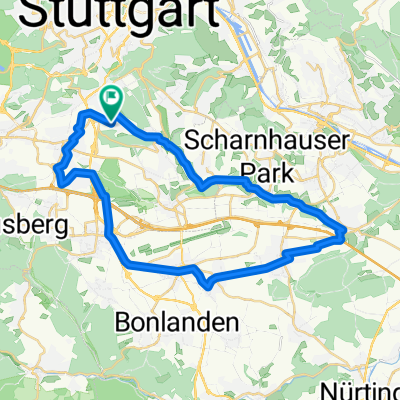
Stuttgart-Vaihingen - Böblingen-Hulb (Landstraße)
A cycling route starting in Leinfelden-Echterdingen, Baden-Württemberg, Germany.
Overview
About this route
Von Stuttgart-Vaihingen über die Gründgensstraße zur ehemaligen IBM-Zentrale, auf der Landstraße am Möchsbrunnen vorbei zum Böblinger Freibad, zur Stadtmitte (Elbenplatz) und auf der Herrenberger Straße ins Industriegebiet Hulb.
- -:--
- Duration
- 14 km
- Distance
- 152 m
- Ascent
- 161 m
- Descent
- ---
- Avg. speed
- ---
- Max. altitude
Continue with Bikemap
Use, edit, or download this cycling route
You would like to ride Stuttgart-Vaihingen - Böblingen-Hulb (Landstraße) or customize it for your own trip? Here is what you can do with this Bikemap route:
Free features
- Save this route as favorite or in collections
- Copy & plan your own version of this route
- Sync your route with Garmin or Wahoo
Premium features
Free trial for 3 days, or one-time payment. More about Bikemap Premium.
- Navigate this route on iOS & Android
- Export a GPX / KML file of this route
- Create your custom printout (try it for free)
- Download this route for offline navigation
Discover more Premium features.
Get Bikemap PremiumFrom our community
Other popular routes starting in Leinfelden-Echterdingen
 Rundstrecke Hoffeld-Denkendorf-Hoffeld
- Distance
- 36.7 km
- Ascent
- 238 m
- Descent
- 259 m
- Location
- Leinfelden-Echterdingen, Baden-Württemberg, Germany
 Hausstrecke
- Distance
- 56.2 km
- Ascent
- 505 m
- Descent
- 482 m
- Location
- Leinfelden-Echterdingen, Baden-Württemberg, Germany
 Echterdingen-Betzenberg-Schaichtal
- Distance
- 36.7 km
- Ascent
- 562 m
- Descent
- 565 m
- Location
- Leinfelden-Echterdingen, Baden-Württemberg, Germany
 Möhringen - Reutlingen grün 42km 430hm
- Distance
- 42.6 km
- Ascent
- 388 m
- Descent
- 423 m
- Location
- Leinfelden-Echterdingen, Baden-Württemberg, Germany
 Vaihingen, Birkach, Ruit, Mettingen, Schlossgarten, Marienplatz, Kaltental
- Distance
- 39.3 km
- Ascent
- 310 m
- Descent
- 310 m
- Location
- Leinfelden-Echterdingen, Baden-Württemberg, Germany
 2009-06-18 MTB
- Distance
- 35.4 km
- Ascent
- 529 m
- Descent
- 529 m
- Location
- Leinfelden-Echterdingen, Baden-Württemberg, Germany
 Echterdingen, Waldfriedhof Stgt., Bärensee, Solitude
- Distance
- 43.9 km
- Ascent
- 418 m
- Descent
- 418 m
- Location
- Leinfelden-Echterdingen, Baden-Württemberg, Germany
 Möhringen - Sindelfingen/KevinKugel 32km
- Distance
- 32.1 km
- Ascent
- 349 m
- Descent
- 353 m
- Location
- Leinfelden-Echterdingen, Baden-Württemberg, Germany
Open it in the app