Chemnitzrunde 67 KM
A cycling route starting in Neukirchen, Saxony, Germany.
Overview
About this route
Nice loop around Chemnitz. NOT suitable for road bikes as there are some forest, meadow, and field paths.
- -:--
- Duration
- 67 km
- Distance
- 733 m
- Ascent
- 764 m
- Descent
- ---
- Avg. speed
- 497 m
- Max. altitude
Route quality
Waytypes & surfaces along the route
Waytypes
Quiet road
26.8 km
(40 %)
Track
13.4 km
(20 %)
Surfaces
Paved
55 km
(82 %)
Unpaved
4.7 km
(7 %)
Asphalt
50.9 km
(76 %)
Gravel
4 km
(6 %)
Continue with Bikemap
Use, edit, or download this cycling route
You would like to ride Chemnitzrunde 67 KM or customize it for your own trip? Here is what you can do with this Bikemap route:
Free features
- Save this route as favorite or in collections
- Copy & plan your own version of this route
- Sync your route with Garmin or Wahoo
Premium features
Free trial for 3 days, or one-time payment. More about Bikemap Premium.
- Navigate this route on iOS & Android
- Export a GPX / KML file of this route
- Create your custom printout (try it for free)
- Download this route for offline navigation
Discover more Premium features.
Get Bikemap PremiumFrom our community
Other popular routes starting in Neukirchen
Erzgebirgstour- Distance
- 96.5 km
- Ascent
- 1,517 m
- Descent
- 1,494 m
- Location
- Neukirchen, Saxony, Germany
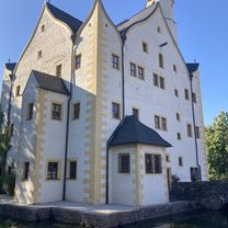
Wasserschloßweg nach Chemnitz Kulturhauptstadt Europa 2025- Distance
- 30.7 km
- Ascent
- 423 m
- Descent
- 423 m
- Location
- Neukirchen, Saxony, Germany
Chemnitz - Südböhmen - Südmähren- Distance
- 844.3 km
- Ascent
- 2,001 m
- Descent
- 2,130 m
- Location
- Neukirchen, Saxony, Germany
Adelsbergturm- Distance
- 31.2 km
- Ascent
- 418 m
- Descent
- 430 m
- Location
- Neukirchen, Saxony, Germany
Chemnitz Tour 2025- Distance
- 15.4 km
- Ascent
- 120 m
- Descent
- 154 m
- Location
- Neukirchen, Saxony, Germany
Eisenweg und Totenstein- Distance
- 53.1 km
- Ascent
- 705 m
- Descent
- 704 m
- Location
- Neukirchen, Saxony, Germany
Wasserschloßweg, Chemnitz nach An der Markthalle, Chemnitz- Distance
- 19 km
- Ascent
- 244 m
- Descent
- 282 m
- Location
- Neukirchen, Saxony, Germany
Hügelige Runde bei Chemnitz- Distance
- 34.1 km
- Ascent
- 717 m
- Descent
- 714 m
- Location
- Neukirchen, Saxony, Germany
Open it in the app

