6 Seen Tou
- 58.8 km
- 93 m
- 94 m
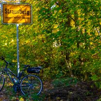
- Johannisthal, State of Berlin, Germany
A cycling route starting in Johannisthal, State of Berlin, Germany.
Overview
In planning
created this 13 years ago
Route highlights
Kanonenberge
Müggelturm
Großer Müggelberg
Ende / Fähren?
Abenteurspielplatz
Continue with Bikemap
You would like to ride Adlershof - Müggelberg or customize it for your own trip? Here is what you can do with this Bikemap route:
Free trial for 3 days, or one-time payment. More about Bikemap Premium.
Discover more Premium features.
Get Bikemap PremiumFrom our community
Open it in the app