

Linares- Arquillos- Navas San Juan- Sto. Virgen La Estella- Arquillos- Linares
A cycling route starting in Linares, Andalusia, Spain.
Overview
About this route
Great route for cycling with some uphill. Varied and beautiful scenery, especially on the descent from the Santuario de la Virgen de la Estrella with the Giribaile in the background. Very good asphalt and little traffic.
- -:--
- Duration
- 79.2 km
- Distance
- 698 m
- Ascent
- 695 m
- Descent
- ---
- Avg. speed
- ---
- Max. altitude

Route quality
Waytypes & surfaces along the route
Waytypes
Road
15.1 km
(19 %)
Track
3.2 km
(4 %)
Surfaces
Paved
72.9 km
(92 %)
Asphalt
69.7 km
(88 %)
Paved (undefined)
3.2 km
(4 %)
Undefined
6.3 km
(8 %)
Route highlights
Points of interest along the route
Point of interest after 0 km
casa
Continue with Bikemap
Use, edit, or download this cycling route
You would like to ride Linares- Arquillos- Navas San Juan- Sto. Virgen La Estella- Arquillos- Linares or customize it for your own trip? Here is what you can do with this Bikemap route:
Free features
- Save this route as favorite or in collections
- Copy & plan your own version of this route
- Sync your route with Garmin or Wahoo
Premium features
Free trial for 3 days, or one-time payment. More about Bikemap Premium.
- Navigate this route on iOS & Android
- Export a GPX / KML file of this route
- Create your custom printout (try it for free)
- Download this route for offline navigation
Discover more Premium features.
Get Bikemap PremiumFrom our community
Other popular routes starting in Linares
 Linares - PK- 15 de la A-301 - Linares
- Distance
- 45.9 km
- Ascent
- 267 m
- Descent
- 392 m
- Location
- Linares, Andalusia, Spain
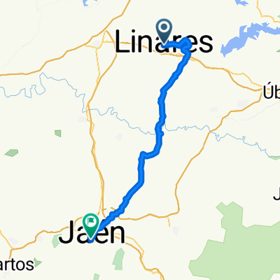 From Linares to Jaén
- Distance
- 57.3 km
- Ascent
- 894 m
- Descent
- 724 m
- Location
- Linares, Andalusia, Spain
 Linares- Jaen- La Higuera- Espeluy- Linares
- Distance
- 119 km
- Ascent
- 837 m
- Descent
- 834 m
- Location
- Linares, Andalusia, Spain
 la cruz
- Distance
- 16.8 km
- Ascent
- 637 m
- Descent
- 640 m
- Location
- Linares, Andalusia, Spain
 Linares- Baeza- Garciez- Bedmar- Jimena- Begijar- Ibros- Linares
- Distance
- 104.8 km
- Ascent
- 1,575 m
- Descent
- 1,575 m
- Location
- Linares, Andalusia, Spain
 Camino de Anibal tramo 1 -2 y 3 Linares- frontera con Italia
- Distance
- 2,368.9 km
- Ascent
- 4,989 m
- Descent
- 5,368 m
- Location
- Linares, Andalusia, Spain
 Linares- Arquillos- Navas San Juan- Sto. Virgen La Estella- Arquillos- Linares
- Distance
- 79.2 km
- Ascent
- 698 m
- Descent
- 695 m
- Location
- Linares, Andalusia, Spain
 Linares- Cruce Albuñuel- Linares
- Distance
- 140.2 km
- Ascent
- 734 m
- Descent
- 733 m
- Location
- Linares, Andalusia, Spain
Open it in the app