

All Over Trail - Accessibile
A cycling route starting in San Benedetto Val di Sambro, Emilia-Romagna, Italy.
Overview
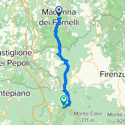
About this route
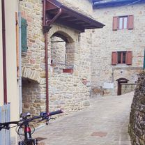
Simple route to discover the valley of San Benedetto Val di Sambro. The circular trail crosses unspoiled and nature-immersed places, where chestnut groves and small crossings frame an itinerary that can also be traveled by handbike and tandem. Worth trying throughout the year to appreciate the changes in the landscape with the changing seasons.
- -:--
- Duration
- 18.1 km
- Distance
- 795 m
- Ascent
- 795 m
- Descent
- ---
- Avg. speed
- 748 m
- Max. altitude

Route quality
Waytypes & surfaces along the route
Waytypes
Quiet road
8 km
(44 %)
Track
4.9 km
(27 %)
Surfaces
Paved
2.4 km
(13 %)
Unpaved
3.6 km
(20 %)
Ground
2.5 km
(14 %)
Asphalt
2.4 km
(13 %)
Continue with Bikemap
Use, edit, or download this cycling route
You would like to ride All Over Trail - Accessibile or customize it for your own trip? Here is what you can do with this Bikemap route:
Free features
- Save this route as favorite or in collections
- Copy & plan your own version of this route
- Sync your route with Garmin or Wahoo
Premium features
Free trial for 3 days, or one-time payment. More about Bikemap Premium.
- Navigate this route on iOS & Android
- Export a GPX / KML file of this route
- Create your custom printout (try it for free)
- Download this route for offline navigation
Discover more Premium features.
Get Bikemap PremiumFrom our community
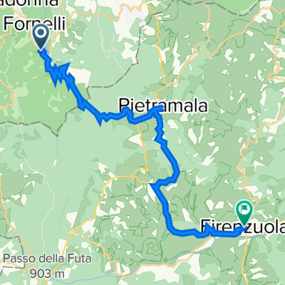
Other popular routes starting in San Benedetto Val di Sambro
 Zan trail
- Distance
- 23.1 km
- Ascent
- 612 m
- Descent
- 596 m
- Location
- San Benedetto Val di Sambro, Emilia-Romagna, Italy
 nach Bologna 2
- Distance
- 94.1 km
- Ascent
- 128 m
- Descent
- 795 m
- Location
- San Benedetto Val di Sambro, Emilia-Romagna, Italy
 1T4 Madonna dei Fornelli - Santa Lucia
- Distance
- 18.5 km
- Ascent
- 679 m
- Descent
- 776 m
- Location
- San Benedetto Val di Sambro, Emilia-Romagna, Italy
 Cammino Degli Dei 02 - Cromoli
- Distance
- 28.5 km
- Ascent
- 526 m
- Descent
- 1,194 m
- Location
- San Benedetto Val di Sambro, Emilia-Romagna, Italy
 alternativa_firenze_monghidoro_madonnafornelli
- Distance
- 108.9 km
- Ascent
- 2,277 m
- Descent
- 3,004 m
- Location
- San Benedetto Val di Sambro, Emilia-Romagna, Italy
 Madonna dei Fornelli - Camping Monte di Fo
- Distance
- 17.4 km
- Ascent
- 617 m
- Descent
- 647 m
- Location
- San Benedetto Val di Sambro, Emilia-Romagna, Italy
 Castel-dell-alpi - Firenzuola
- Distance
- 21.4 km
- Ascent
- 534 m
- Descent
- 861 m
- Location
- San Benedetto Val di Sambro, Emilia-Romagna, Italy
 All Over Trail - Accessibile
- Distance
- 18.1 km
- Ascent
- 795 m
- Descent
- 795 m
- Location
- San Benedetto Val di Sambro, Emilia-Romagna, Italy
Open it in the app