Landstraße nach Elisabeth-Geissler-Ruckmich-Straße
- 18.6 km
- 120 m
- 161 m
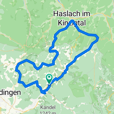
- Gutach im Breisgau, Baden-Wurttemberg, Germany
A cycling route starting in Gutach im Breisgau, Baden-Wurttemberg, Germany.
Overview
very beautiful and challenging tour (I rode this clockwise) at Hohen Eck just before Oberspitzenbach there are about 500m unpaved but very passable. (alternatively, you can also ride over Hühnersedel, where there are about 1.5km unpaved, but also very passable) after Mühlenbach, turn left into Bücherntal up to Landwassereck... the last kilometer has a gradient of up to 20%... but then it goes down nicely.
created this 13 years ago
Continue with Bikemap
You would like to ride klein aber fein vom Elztals ins Kinzigtal or customize it for your own trip? Here is what you can do with this Bikemap route:
Free trial for 3 days, or one-time payment. More about Bikemap Premium.
Discover more Premium features.
Get Bikemap PremiumFrom our community
Open it in the app