

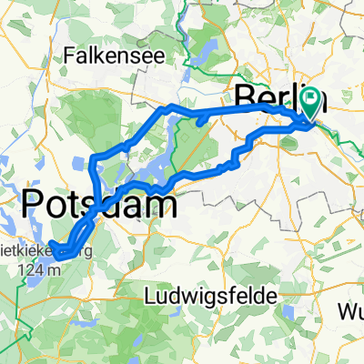
East Side Gallery – Rathaus Spandau
A cycling route starting in Treptow, State of Berlin, Germany.
Overview
About this route
- 1 h 37 min
- Duration
- 25.9 km
- Distance
- 92 m
- Ascent
- 88 m
- Descent
- 16 km/h
- Avg. speed
- 48 m
- Max. altitude

Route quality
Waytypes & surfaces along the route
Waytypes
Quiet road
6 km
(23 %)
Pedestrian area
5.4 km
(21 %)
Surfaces
Paved
21.5 km
(83 %)
Unpaved
0.3 km
(1 %)
Asphalt
20.2 km
(78 %)
Concrete
0.8 km
(3 %)
Route highlights
Points of interest along the route
Point of interest after 8.2 km
Deine alte Wohnung

Point of interest after 19.6 km

Point of interest after 25.9 km
Continue with Bikemap
Use, edit, or download this cycling route
You would like to ride East Side Gallery – Rathaus Spandau or customize it for your own trip? Here is what you can do with this Bikemap route:
Free features
- Save this route as favorite or in collections
- Copy & plan your own version of this route
- Sync your route with Garmin or Wahoo
Premium features
Free trial for 3 days, or one-time payment. More about Bikemap Premium.
- Navigate this route on iOS & Android
- Export a GPX / KML file of this route
- Create your custom printout (try it for free)
- Download this route for offline navigation
Discover more Premium features.
Get Bikemap PremiumFrom our community
Other popular routes starting in Treptow
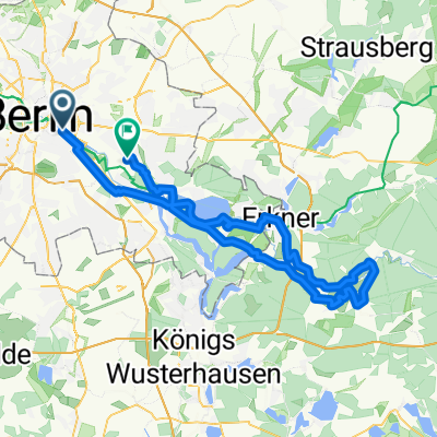
 Hermannplatz – Spandau – Havelchaussee – Wilmersdorfer Fenn
- Distance
- 58.8 km
- Ascent
- 160 m
- Descent
- 155 m
- Location
- Treptow, State of Berlin, Germany
 Sunsetherbstrunde
- Distance
- 35.4 km
- Ascent
- 38 m
- Descent
- 34 m
- Location
- Treptow, State of Berlin, Germany
 Berlin-Darmstadt Rennrad
- Distance
- 558.2 km
- Ascent
- 1,417 m
- Descent
- 1,315 m
- Location
- Treptow, State of Berlin, Germany
 F'hain - Schöneweide - Gropiusstadt - Neukölln - F'hain
- Distance
- 26.4 km
- Ascent
- 31 m
- Descent
- 15 m
- Location
- Treptow, State of Berlin, Germany
 Wrangelstraße, Berlin to Wrangelstraße, Berlin
- Distance
- 104.1 km
- Ascent
- 569 m
- Descent
- 569 m
- Location
- Treptow, State of Berlin, Germany
 Spreewiesentour
- Distance
- 86.3 km
- Ascent
- 228 m
- Descent
- 222 m
- Location
- Treptow, State of Berlin, Germany
 Rund um Schönefeld
- Distance
- 48.5 km
- Ascent
- 73 m
- Descent
- 83 m
- Location
- Treptow, State of Berlin, Germany
 KW Runde
- Distance
- 80.9 km
- Ascent
- 61 m
- Descent
- 58 m
- Location
- Treptow, State of Berlin, Germany
Open it in the app