

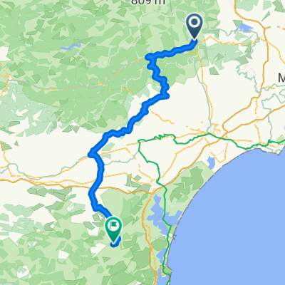
Bédarieux to Gignac
A cycling route starting in Bédarieux, Occitanie, France.
Overview
About this route
Although all of this ride was on excellent roads with good scenery and mostly low traffic conditions, the D157 and D8 portions are outstanding for their remoteness and their scenery. Highly recommended.
None of the climbing was overly steep.
- 4 h 39 min
- Duration
- 46.8 km
- Distance
- 332 m
- Ascent
- 475 m
- Descent
- 10.1 km/h
- Avg. speed
- 369 m
- Max. altitude

Route photos


Route quality
Waytypes & surfaces along the route
Waytypes
Busy road
22.6 km
(48 %)
Road
19.9 km
(43 %)
Surfaces
Paved
16.5 km
(35 %)
Unpaved
0.1 km
(<1 %)
Asphalt
15 km
(32 %)
Concrete
1.5 km
(3 %)
Continue with Bikemap
Use, edit, or download this cycling route
You would like to ride Bédarieux to Gignac or customize it for your own trip? Here is what you can do with this Bikemap route:
Free features
- Save this route as favorite or in collections
- Copy & plan your own version of this route
- Sync your route with Garmin or Wahoo
Premium features
Free trial for 3 days, or one-time payment. More about Bikemap Premium.
- Navigate this route on iOS & Android
- Export a GPX / KML file of this route
- Create your custom printout (try it for free)
- Download this route for offline navigation
Discover more Premium features.
Get Bikemap PremiumFrom our community
Other popular routes starting in Bédarieux
 France bedarieux to minerve
- Distance
- 79.2 km
- Ascent
- 884 m
- Descent
- 933 m
- Location
- Bédarieux, Occitanie, France
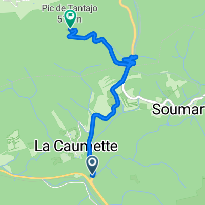 PIC de TANTAJO, por La Caumette
- Distance
- 3.3 km
- Ascent
- 308 m
- Descent
- 200 m
- Location
- Bédarieux, Occitanie, France
 Genève-Argelès - 6
- Distance
- 127.1 km
- Ascent
- 633 m
- Descent
- 743 m
- Location
- Bédarieux, Occitanie, France
 BCMF CAROUX ESPINOUSE TOURISTE
- Distance
- 220.9 km
- Ascent
- 2,353 m
- Descent
- 2,357 m
- Location
- Bédarieux, Occitanie, France
 Bedarieux Mazamet
- Distance
- 73.7 km
- Ascent
- 445 m
- Descent
- 398 m
- Location
- Bédarieux, Occitanie, France
 BCMF CAROUX ESPINOUSE RANDONNEUR
- Distance
- 221.1 km
- Ascent
- 2,325 m
- Descent
- 2,323 m
- Location
- Bédarieux, Occitanie, France
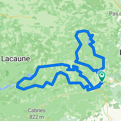
 Etape 12 – De Bédarieux à Cabrerolles - Itinéraire Sud
- Distance
- 22.8 km
- Ascent
- 732 m
- Descent
- 665 m
- Location
- Bédarieux, Occitanie, France
 Bedarieux, Mazamet, Revel, canal du Midí, Carcasona, Beziers, Marseillan.
- Distance
- 360.8 km
- Ascent
- 438 m
- Descent
- 634 m
- Location
- Bédarieux, Occitanie, France
Open it in the app