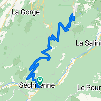
Tour de l'Alpe du Grand Serre
- 80.9 km
- 2,132 m
- 2,127 m
- Vaulnaveys-le-Bas, Auvergne-Rhône-Alpes, France
A cycling route starting in Vaulnaveys-le-Bas, Auvergne-Rhône-Alpes, France.
Overview
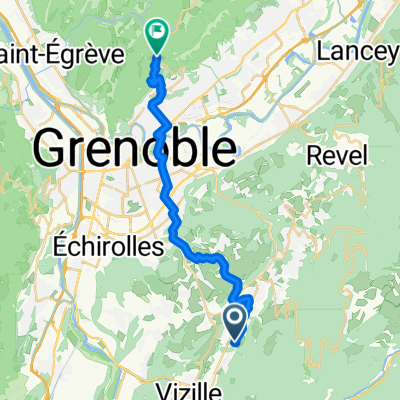
Al sur de su vertiente más conocida, desde la localidad de Séchilienne y a través del col de Luitel, tenemos un temible ascenso a Chamrousse. La destacada ruta está situada en la región de Auvernia-Ródano-Alpes, cerca de la ciudad de Grenoble, en el departamento de Isère, Francia. Este recorrido combina historia, naturaleza y relevancia deportiva, especialmente en el mundo del ciclismo.
created this 1 year ago
\"")
Route quality
Road
11.7 km
(63 %)
Access road
0.2 km
(1 %)
Paved
8 km
(43 %)
Asphalt
7.6 km
(41 %)
Paved (undefined)
0.4 km
(2 %)
Undefined
10.6 km
(57 %)
Continue with Bikemap
You would like to ride ASCENSO A CHAMROUSSE (por el col de Lutiel) or customize it for your own trip? Here is what you can do with this Bikemap route:
Free trial for 3 days, or one-time payment. More about Bikemap Premium.
Discover more Premium features.
Get Bikemap PremiumFrom our community
Open it in the app