

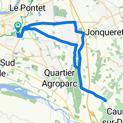
Le Pontet (Avignon) to Saint-Saturnin-lès-Apt
A cycling route starting in Le Pontet, Provence-Alpes-Côte d'Azur Region, France.
Overview
About this route
This was a good route to get out of Le Pontet, but there was inevitably a lot of traffic. D28 for the most part had great road shoulder.
One unintentional mistake along the way was to miss in Pernes-les-Fontaines the turn-off to D28. As a result, we ended up on D1, which while relatively light traffic, had no shoulder and lengthened our ride by several kilometers. I'm sure that D28 would have been an even lower traffic road to the east of Pernes-les-Fontaines. Later, after returning into St-Didier on D39 nearer to our intended route, we found a marked cycling path that took us along country lanes running through vineyards to D4. All of it was paved, but some parts not so well.
Taking the Route de Beaucet (D247) up to Venasque was steep, but it was one of the best decisions. (The alternative was to continue on D4, which I'm sure would have been very nice.) Venasque was a very pretty village with a castle that overlooked Mt. Ventoux. This was a gorgeous part of our ride.
The climb on D4 up to the Col de Murs (627M) was excellent. Beautiful and very lightly trafficked. I think we saw more cyclists than cars...and we didn't see that many cyclists. The descent from the Col had some very nice views.
Great ride we highly recommend.
- 6 h 32 min
- Duration
- 63 km
- Distance
- 921 m
- Ascent
- 555 m
- Descent
- 9.6 km/h
- Avg. speed
- 626 m
- Max. altitude

Route photos
 to Saint-Saturnin-lès-Apt\"")
 to Saint-Saturnin-lès-Apt\"")
 to Saint-Saturnin-lès-Apt\"")
 to Saint-Saturnin-lès-Apt\"")
 to Saint-Saturnin-lès-Apt\"")
 to Saint-Saturnin-lès-Apt\"")
 to Saint-Saturnin-lès-Apt\"")
 to Saint-Saturnin-lès-Apt\"")
Route quality
Waytypes & surfaces along the route
Waytypes
Road
10.1 km
(16 %)
Quiet road
8.2 km
(13 %)
Surfaces
Paved
52.9 km
(84 %)
Unpaved
0.6 km
(1 %)
Asphalt
52.9 km
(84 %)
Ground
0.6 km
(1 %)
Undefined
9.4 km
(15 %)
Continue with Bikemap
Use, edit, or download this cycling route
You would like to ride Le Pontet (Avignon) to Saint-Saturnin-lès-Apt or customize it for your own trip? Here is what you can do with this Bikemap route:
Free features
- Save this route as favorite or in collections
- Copy & plan your own version of this route
- Sync your route with Garmin or Wahoo
Premium features
Free trial for 3 days, or one-time payment. More about Bikemap Premium.
- Navigate this route on iOS & Android
- Export a GPX / KML file of this route
- Create your custom printout (try it for free)
- Download this route for offline navigation
Discover more Premium features.
Get Bikemap PremiumFrom our community
Other popular routes starting in Le Pontet
 De 45 Rue Charles Chartier, Avignon à 45 Rue Charles Chartier, Avignon
- Distance
- 53.8 km
- Ascent
- 257 m
- Descent
- 258 m
- Location
- Le Pontet, Provence-Alpes-Côte d'Azur Region, France
 hghgh
hghgh- Distance
- 2.1 km
- Ascent
- 4 m
- Descent
- 5 m
- Location
- Le Pontet, Provence-Alpes-Côte d'Azur Region, France
 Le Pontet (Avignon) to Saint-Saturnin-lès-Apt
- Distance
- 63 km
- Ascent
- 921 m
- Descent
- 555 m
- Location
- Le Pontet, Provence-Alpes-Côte d'Azur Region, France
 110 km Monts de Vaucluse Le Pontet Murs Lioux Saint Lambert Indochinois Méthamis Malemort Pernes
- Distance
- 109.7 km
- Ascent
- 1,204 m
- Descent
- 1,204 m
- Location
- Le Pontet, Provence-Alpes-Côte d'Azur Region, France
 Avignon-Rousillion (59)
- Distance
- 50.8 km
- Ascent
- 504 m
- Descent
- 296 m
- Location
- Le Pontet, Provence-Alpes-Côte d'Azur Region, France
 De 45 Rue Charles Chartier, Avignon à 45 Rue Charles Chartier, Avignon
- Distance
- 29.9 km
- Ascent
- 164 m
- Descent
- 162 m
- Location
- Le Pontet, Provence-Alpes-Côte d'Azur Region, France
 De 45 Rue Charles Chartier, Avignon à 45 Rue Charles Chartier, Avignon
- Distance
- 22.5 km
- Ascent
- 153 m
- Descent
- 152 m
- Location
- Le Pontet, Provence-Alpes-Côte d'Azur Region, France
 avignon sault
- Distance
- 59.9 km
- Ascent
- 1,081 m
- Descent
- 395 m
- Location
- Le Pontet, Provence-Alpes-Côte d'Azur Region, France
Open it in the app