
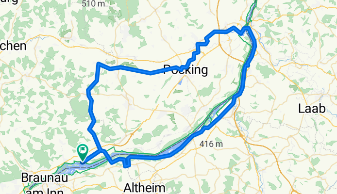
Innrunde mit Teil des Rottalradweges
A cycling route starting in Ering, Bavaria, Germany.
Overview
About this route
leichter Anfang mit kaum Steigungen - dann von der Rott zurück an den Inn Überquerung einer Hügelkette zurück nach Ering
- -:--
- Duration
- 88.8 km
- Distance
- 304 m
- Ascent
- 303 m
- Descent
- ---
- Avg. speed
- ---
- Max. altitude

Route quality
Waytypes & surfaces along the route
Waytypes
Road
30.1 km
(34 %)
Quiet road
28 km
(32 %)
Surfaces
Paved
44.3 km
(50 %)
Unpaved
8.6 km
(10 %)
Asphalt
43.9 km
(49 %)
Gravel
7 km
(8 %)
Continue with Bikemap
Use, edit, or download this cycling route
You would like to ride Innrunde mit Teil des Rottalradweges or customize it for your own trip? Here is what you can do with this Bikemap route:
Free features
- Save this route as favorite or in collections
- Copy & plan your own version of this route
- Split it into stages to create a multi-day tour
- Sync your route with Garmin or Wahoo
Premium features
Free trial for 3 days, or one-time payment. More about Bikemap Premium.
- Navigate this route on iOS & Android
- Export a GPX / KML file of this route
- Create your custom printout (try it for free)
- Download this route for offline navigation
Discover more Premium features.
Get Bikemap PremiumFrom our community
Other popular routes starting in Ering
 Passauer Straße 11, Ering nach Im Eichbüchl 7, Schärding
- Distance
- 40.4 km
- Ascent
- 202 m
- Descent
- 228 m
- Location
- Ering, Bavaria, Germany
 Ering 3
- Distance
- 34.5 km
- Ascent
- 638 m
- Descent
- 638 m
- Location
- Ering, Bavaria, Germany
 Ering 2
- Distance
- 44 km
- Ascent
- 928 m
- Descent
- 926 m
- Location
- Ering, Bavaria, Germany
 Gerade Fahrt in Simbach am Inn
- Distance
- 17.7 km
- Ascent
- 64 m
- Descent
- 43 m
- Location
- Ering, Bavaria, Germany
 Ering Bad Füssing
- Distance
- 40.4 km
- Ascent
- 66 m
- Descent
- 69 m
- Location
- Ering, Bavaria, Germany
 Passauer Straße 14–28, Ering nach Wildenhag 22, Wildenhag
- Distance
- 70.1 km
- Ascent
- 527 m
- Descent
- 274 m
- Location
- Ering, Bavaria, Germany
 Innrunde mit Teil des Rottalradweges
- Distance
- 88.8 km
- Ascent
- 304 m
- Descent
- 303 m
- Location
- Ering, Bavaria, Germany
 Ering - Braunau
- Distance
- 13.3 km
- Ascent
- 71 m
- Descent
- 52 m
- Location
- Ering, Bavaria, Germany
Open it in the app