

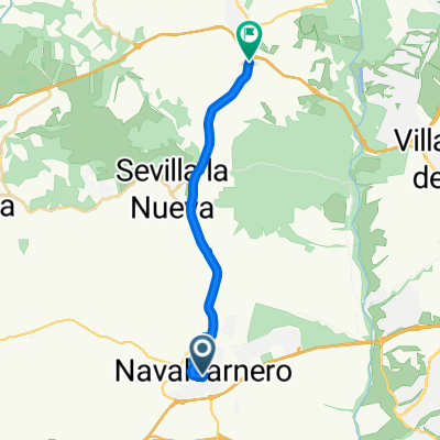
navalcarnero- mostoles, el soto- navalcarnero
A cycling route starting in Navalcarnero, Madrid, Spain.
Overview
About this route
affordable and comfortable route. Ideal for a day with just the right timing. With little elevation at the beginning, almost all downhill, to the river, a gentle climb to Móstoles and comfortable along the stretch by the river. Once we start the return, after leaving the Vega del Guadarrama, there is a long but comfortable climb up to the M 600. We ride flat to Navalcarnero from the M600. Come on and enjoy!
- -:--
- Duration
- 37.4 km
- Distance
- 230 m
- Ascent
- 230 m
- Descent
- ---
- Avg. speed
- ---
- Max. altitude
Route highlights
Points of interest along the route
Point of interest after 12 km
zona con fuentes para repostar agua, si fuese necesario.
Point of interest after 12.5 km
tramo de asfalto, circulación de coches
Point of interest after 13.5 km
Point of interest after 19.9 km
comienzo de tramo accidentado, pero divertido.
Point of interest after 23.8 km
final de zona mas accidentada.
Point of interest after 24.1 km
cruce del puente de hierro, tramo abierto al trafico.
Point of interest after 26.7 km
agua en curva ciega, dependiendo de estación
Point of interest after 34.6 km
cruce con carrertera muy transitada.
Point of interest after 35.5 km
cruce con carretera muy transitada.
Point of interest after 36.5 km
Continue with Bikemap
Use, edit, or download this cycling route
You would like to ride navalcarnero- mostoles, el soto- navalcarnero or customize it for your own trip? Here is what you can do with this Bikemap route:
Free features
- Save this route as favorite or in collections
- Copy & plan your own version of this route
- Sync your route with Garmin or Wahoo
Premium features
Free trial for 3 days, or one-time payment. More about Bikemap Premium.
- Navigate this route on iOS & Android
- Export a GPX / KML file of this route
- Create your custom printout (try it for free)
- Download this route for offline navigation
Discover more Premium features.
Get Bikemap PremiumFrom our community
Other popular routes starting in Navalcarnero
 Callejón de los Herreros, Navalcarnero to M600, Brunete
- Distance
- 14 km
- Ascent
- 104 m
- Descent
- 106 m
- Location
- Navalcarnero, Madrid, Spain
 Ruta Club BTT Angel - mtb la estación combi1 30km + 30km
- Distance
- 62.9 km
- Ascent
- 459 m
- Descent
- 460 m
- Location
- Navalcarnero, Madrid, Spain
 Navalcarnero-Chapineria-Navalcarnero
- Distance
- 54 km
- Ascent
- 551 m
- Descent
- 551 m
- Location
- Navalcarnero, Madrid, Spain
 Navalcarnero - Brunete - Villanueva de la Cañada - ESA - Villaviciosa de Odón
- Distance
- 51.2 km
- Ascent
- 286 m
- Descent
- 288 m
- Location
- Navalcarnero, Madrid, Spain
 navalcarnero-envalse fuenmayor
- Distance
- 88.2 km
- Ascent
- 439 m
- Descent
- 430 m
- Location
- Navalcarnero, Madrid, Spain
 sevilla la nueva brunete
- Distance
- 41.7 km
- Ascent
- 987 m
- Descent
- 948 m
- Location
- Navalcarnero, Madrid, Spain
 De Calle de la Cuesta del Menor 11A, Navalcarnero a Cuesta Menor 7, Navalcarnero
- Distance
- 24.9 km
- Ascent
- 205 m
- Descent
- 201 m
- Location
- Navalcarnero, Madrid, Spain
 navalcarnero- mostoles, el soto- navalcarnero
- Distance
- 37.4 km
- Ascent
- 230 m
- Descent
- 230 m
- Location
- Navalcarnero, Madrid, Spain
Open it in the app