

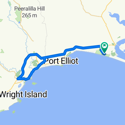
Ashbourne Lunch Ride - Glwa,CC Winery,Braeside,Signal Flat Rds,Ahbourne,Deep Ck,Airport,Glwa
A cycling route starting in Goolwa, South Australia, Australia.
Overview
About this route
Leader: Geoff (original)
Moving Time 3hrs 45mins
Picturesque ride with lunch at Greenman Tavern, Ashbourne. Take food with you for sustenance.
- -:--
- Duration
- 68.2 km
- Distance
- 376 m
- Ascent
- 376 m
- Descent
- ---
- Avg. speed
- ---
- Max. altitude
Route quality
Waytypes & surfaces along the route
Waytypes
Quiet road
35.1 km
(51 %)
Busy road
28.7 km
(42 %)
Surfaces
Paved
46.7 km
(69 %)
Unpaved
21.3 km
(31 %)
Asphalt
29.1 km
(43 %)
Unpaved (undefined)
21.3 km
(31 %)
Continue with Bikemap
Use, edit, or download this cycling route
You would like to ride Ashbourne Lunch Ride - Glwa,CC Winery,Braeside,Signal Flat Rds,Ahbourne,Deep Ck,Airport,Glwa or customize it for your own trip? Here is what you can do with this Bikemap route:
Free features
- Save this route as favorite or in collections
- Copy & plan your own version of this route
- Sync your route with Garmin or Wahoo
Premium features
Free trial for 3 days, or one-time payment. More about Bikemap Premium.
- Navigate this route on iOS & Android
- Export a GPX / KML file of this route
- Create your custom printout (try it for free)
- Download this route for offline navigation
Discover more Premium features.
Get Bikemap PremiumFrom our community
Other popular routes starting in Goolwa
 Nangkita, Mt Compass, Tooperang
- Distance
- 61.6 km
- Ascent
- 320 m
- Descent
- 320 m
- Location
- Goolwa, South Australia, Australia
 Boats Planes Trains - Goolwa,Hindmarsh Is,Laffin Point, Airport Road,Middleton,Goolwa
- Distance
- 40.4 km
- Ascent
- 116 m
- Descent
- 119 m
- Location
- Goolwa, South Australia, Australia
 Goolwa loop 2
- Distance
- 42 km
- Ascent
- 166 m
- Descent
- 166 m
- Location
- Goolwa, South Australia, Australia
 Goolwa to Middleton Beach Loop
- Distance
- 16.4 km
- Ascent
- 692 m
- Descent
- 696 m
- Location
- Goolwa, South Australia, Australia
 Goolwa (north) to Victor Harbour to Rosetta Head (The Bluff)
- Distance
- 40.1 km
- Ascent
- 232 m
- Descent
- 194 m
- Location
- Goolwa, South Australia, Australia
 Goolwa VH via Hindmarsh River
- Distance
- 45.3 km
- Ascent
- 147 m
- Descent
- 145 m
- Location
- Goolwa, South Australia, Australia
 Skewes Currency Ck, Gould, Deep Ck, Frome part, Boettcher
- Distance
- 38.7 km
- Ascent
- 211 m
- Descent
- 212 m
- Location
- Goolwa, South Australia, Australia
 Kokoda Track - Goolwa, Mosquito, Kokoda, Crows Nest,Goolwa
- Distance
- 49.7 km
- Ascent
- 422 m
- Descent
- 422 m
- Location
- Goolwa, South Australia, Australia
Open it in the app