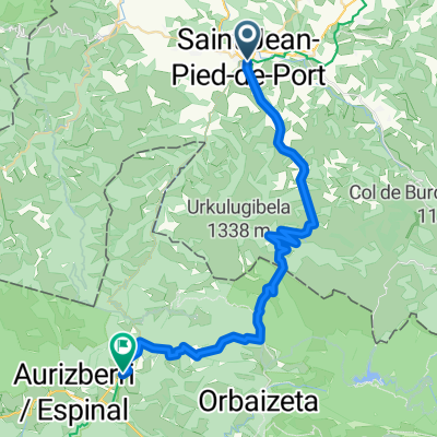
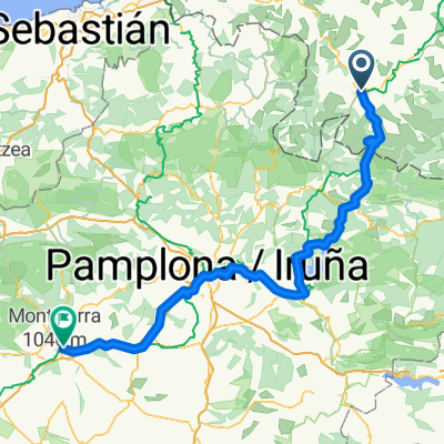
'7-Camino - Navarra par Roncesvalles
A cycling route starting in Saint-Jean-Pied-de-Port, Nouvelle-Aquitaine, France.
Overview
About this route
And now we are going to climb to discover Roncesvalles.
- -:--
- Duration
- 158.9 km
- Distance
- 1,699 m
- Ascent
- 1,552 m
- Descent
- ---
- Avg. speed
- ---
- Max. altitude
Route quality
Waytypes & surfaces along the route
Waytypes
Road
68.3 km
(43 %)
Cycleway
50.9 km
(32 %)
Surfaces
Paved
49.3 km
(31 %)
Asphalt
49.3 km
(31 %)
Undefined
109.7 km
(69 %)
Route highlights
Points of interest along the route
Point of interest after 0 km
Poste Frontière - España Las Ventas
Point of interest after 26.9 km
Alto de Mezkiritz Monumento de Nuestra Señora de Roncesvalles
Point of interest after 38.8 km
Alto de Erro
Point of interest after 49.5 km
Akerreta Iglesia de la Transfiguración del Señor (medieval) reformada (XVIIIe).
Point of interest after 52.5 km
Zuriain Iglesia de San Millán (XVe-XVIe). Puente.
Point of interest after 54.3 km
Irotz Iglesia de San Pedro (medieval reformada). Puente medieval de Iturgáiz. Fuente.
Point of interest after 71.3 km
Zizur Mayor Iglesia de San Andrés.
Point of interest after 73.9 km
Galar Iglesia de San Martín.
Point of interest after 83.6 km
Basongaiz
Point of interest after 115.1 km
Ayegui Iglesia de San Martín de Tours – XVIIe. Ermita del Pico de Montjurra o de San Ciprián.
Continue with Bikemap
Use, edit, or download this cycling route
You would like to ride '7-Camino - Navarra par Roncesvalles or customize it for your own trip? Here is what you can do with this Bikemap route:
Free features
- Save this route as favorite or in collections
- Copy & plan your own version of this route
- Split it into stages to create a multi-day tour
- Sync your route with Garmin or Wahoo
Premium features
Free trial for 3 days, or one-time payment. More about Bikemap Premium.
- Navigate this route on iOS & Android
- Export a GPX / KML file of this route
- Create your custom printout (try it for free)
- Download this route for offline navigation
Discover more Premium features.
Get Bikemap PremiumFrom our community
Other popular routes starting in Saint-Jean-Pied-de-Port
 Deutschland - Portugal (Berlin - Faro) FR 35 SJPP - Burguete
- Distance
- 30.5 km
- Ascent
- 922 m
- Descent
- 240 m
- Location
- Saint-Jean-Pied-de-Port, Nouvelle-Aquitaine, France
 St Jean Pied de Port, France to Burguete, Spain
- Distance
- 39.9 km
- Ascent
- 1,727 m
- Descent
- 998 m
- Location
- Saint-Jean-Pied-de-Port, Nouvelle-Aquitaine, France
 Spanien EuroVelo 3
- Distance
- 940.5 km
- Ascent
- 17,417 m
- Descent
- 17,553 m
- Location
- Saint-Jean-Pied-de-Port, Nouvelle-Aquitaine, France
 '6-Camino - France par Roncesvalles
- Distance
- 8.3 km
- Ascent
- 241 m
- Descent
- 192 m
- Location
- Saint-Jean-Pied-de-Port, Nouvelle-Aquitaine, France
 Santiago 2016 (12. dnevna)
- Distance
- 915.4 km
- Ascent
- 4,222 m
- Descent
- 4,277 m
- Location
- Saint-Jean-Pied-de-Port, Nouvelle-Aquitaine, France
 Saint-Jean-Pied-de-Port - Pamplona
- Distance
- 85.3 km
- Ascent
- 999 m
- Descent
- 699 m
- Location
- Saint-Jean-Pied-de-Port, Nouvelle-Aquitaine, France
 Camino de Santiago 2009
- Distance
- 811.8 km
- Ascent
- 4,314 m
- Descent
- 4,212 m
- Location
- Saint-Jean-Pied-de-Port, Nouvelle-Aquitaine, France
 Saint-Jean-Pied-de-Port - Estella-Lizarra
- Distance
- 141.1 km
- Ascent
- 3,856 m
- Descent
- 3,605 m
- Location
- Saint-Jean-Pied-de-Port, Nouvelle-Aquitaine, France
Open it in the app


